Old Maps of Dakota Mobile Home Park Colonia, Texas for Metal Detecting
Plan your next treasure hunt with 13 historic maps of Dakota Mobile Home Park Colonia. Find old homesites, ghost towns, trails, and gathering spots that may be lost to time — perfect for identifying promising metal detecting locations.
- Locate forgotten sites: Uncover places like long-lost settlements, abandoned rail lines, or gathering spots.
- Plan better hunts: Use map overlays combined with LiDAR or satellite views to narrow in on historically rich areas.
- Made for detectorists: Thousands of hobbyists use these maps to discover relics, coins, and hidden history.
Use these historic maps to boost your research and find new opportunities beneath the surface of Dakota Mobile Home Park Colonia.
Dakota Mobile Home Park Colonia, TX maps
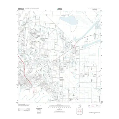
(13)- 1930 Map of East Brownsville
 1930 East Brownsville1930 Print · USGSBrownsville and the Rio Grande borderlands are captured here just as early flight and rail were transforming the South Texas landscape. Researchers can locate Fort Brown, trace the winding Resaca de la Palma, and find old rural schools like Jardin Sch.
 - 1936 Map of East Brownsville
 1936 East Brownsville1936 Print · USGSBrownsville and the lower Rio Grande valley are seen here in the mid-1930s, highlighting a landscape of oxbow resacas and international border crossings. Trace the historical grounds of De La Palma Battlefield, the early Brownsville Airport, and the grounds of Fort Brown.3 unique versions available
 - 1953 Map of Brownsville
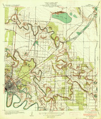
 1953 Brownsville1953 Print · USGSSouth Texas ranchlands and the Lower Rio Grande Valley are captured here in the early fifties as the region's irrigation and shipping networks expanded. Genealogists and historians can trace family landholdings like Tecolote Ranch or follow the route of the St Louis Brownsville and Mexico rail line through Sebastian and Yturria.
 - 1955 Map of East Brownsville, 1957 Print
 1955 East Brownsville1957 Print · USGSMid-century Brownsville and the Rio Grande frontier are documented here during a period of rapid industrial and aerial growth. Genealogists can trace family footprints at Buena Vista Cemetery and Santa Rosalia Cem or locate local landmarks like Southmost College and the Old Fort Brown Reservation.6 unique versions available
 - 1955 Map of Fort Brown, 1958 Print
 1955 Fort Brown1958 Print · USGSBrownsville and the lower Rio Grande valley are captured here in the mid-fifties as the region's irrigation and shipping networks matured. Trace ancestral roots at the Buena Vista Cem or explore military history at Fort Brown and the Palmito Hill Battlefield.
 - 1956 Map of Brownsville, 1969 Print
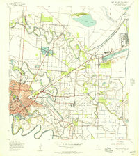
 1956 Brownsville1969 Print · USGSThe Texas-Mexico borderlands and the Gulf coast come alive in this mid-century survey of the Rio Grande Valley. Genealogists and historians can trace the reach of the Missouri Pacific rail lines through citrus country to schools like Las Yescas and Palm Grove.2 unique versions available
 - 1962 Map of Brownsville
 1962 Brownsville1962 Print · USGSThe Lower Rio Grande Valley in the early sixties was a landscape of coastal wildlands, booming oil fields, and international border commerce. Trace the development of this frontier region through landmarks like Harlingen Air Force Base, Boca Chica Island, and the Willamar Oil Field.
 - 1992 Map of Brownsville
 1992 Brownsville1992 Print · USGSThe Lower Rio Grande Valley in the early nineties shows a dense network of resacas and historic battlegrounds at the international border. Genealogists and historians can trace family roots in Buenavista or La Burrita, and locate strategic sites like Fort Brown and Palmito Hill Battlefield.
 - 2010 Map of East Brownsville, 2010 Print
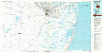
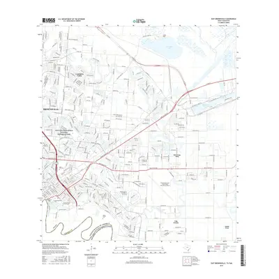
 2010 East Brownsville2010 Print · USGSCovers Dakota Mobile Home Park Colonia, including Brownsville, Cameron Park, and other nearby areas
 - 2012 Map of East Brownsville, 2012 Print
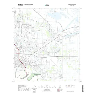
 2012 East Brownsville2012 Print · USGSCovers Dakota Mobile Home Park Colonia, including Brownsville, Cameron Park, and other nearby areas
 - 2016 Map of East Brownsville, 2016 Print
 2016 East Brownsville2016 Print · USGSCovers Dakota Mobile Home Park Colonia, including Brownsville, Cameron Park, and other nearby areas
 - 2019 Map of East Brownsville, 2019 Print
 2019 East Brownsville2019 Print · USGSCovers Dakota Mobile Home Park Colonia, including Brownsville, Cameron Park, and other nearby areas
 - 2022 Map of East Brownsville, 2022 Print
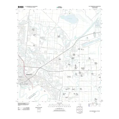
 2022 East Brownsville2022 Print · USGSBrownsville and the international border come into sharp focus in this recent survey of the Rio Grande delta. Researchers can trace local heritage through the Cameron County Courthouse, Santa Rosalia Cem, and the maritime industry of the Brownsville Ship Channel.
End of results
Showing maps 1-13 of 13
Top cities near Dakota Mobile Home Park Colonia
- Brownsville historical maps
- Harlingen historical maps
- San Benito historical maps
- Cameron Park historical maps
- Los Fresnos historical maps
- Port Isabel historical maps
See more
Frequently asked questions
- What are the different types of historical maps available for Dakota Mobile Home Park Colonia?
- What is the oldest map of Dakota Mobile Home Park Colonia?
- Where can I purchase historical maps of Dakota Mobile Home Park Colonia for my home or office?
- Where can I download high-res historical maps of Dakota Mobile Home Park Colonia?
- Are there historical topographic maps available for Dakota Mobile Home Park Colonia?
- Is there historical aerial imagery available for Dakota Mobile Home Park Colonia?
- Where are historical maps of Dakota Mobile Home Park Colonia sourced from?