Old Maps of Carson County, Texas for Hiking & Exploration
Hike through history with 146 historic maps of Carson County. Explore old trails, ghost towns, and forgotten backroads — perfect for outdoor adventurers and local explorers.
- Rediscover forgotten places: Map out old mining camps, roads, and footpaths that no longer exist on modern maps.
- Layer with modern tools: Combine with LiDAR or satellite views to plan hikes through historical terrain.
- Made for exploration: Popular among hikers, overlanders, and local history lovers.
Use these maps to find adventure and explore the hidden past of Carson County.
Carson County, TX maps
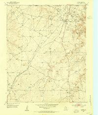
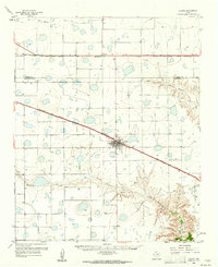
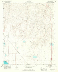
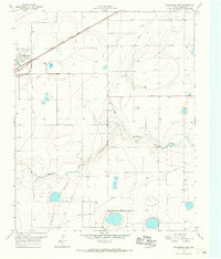
(146)- 1939 Map of Sanford
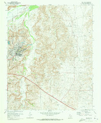
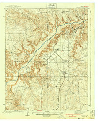 1939 Sanford1939 Print · USGSThe Texas Panhandle comes alive in the late 1930s as ranching and oil industries converge along the Canadian River. Researchers can trace the layout of Fritch and Sanford, or locate family landmarks like Deahl Ranch and Ingerton Ranch.2 unique versions available
 - 1953 Map of Deal, 1954 Print
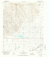
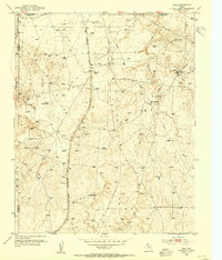 1953 Deal1954 Print · USGSThe Texas Panhandle in the early fifties was a landscape of expansive cattle spreads and critical rail infrastructure. Trace the Rock Island Line past Poling Ranch and Bennett Ranch, or locate industrial landmarks like the Huber Water Sta.
 - 1953 Map of Borger SE, 1954 Print
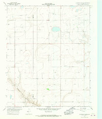
 1953 Borger SE1954 Print · USGSCarson County was at the height of its mid-century energy boom when this survey recorded the industrial expansion across the Panhandle. Researchers can trace the extensive network of the Burnett Oil Field and Garner Oil Field, including infrastructure like the Burnett Booster Sta and numerous gas wells.
 - 1953 Map of Pomeroy, 1954 Print
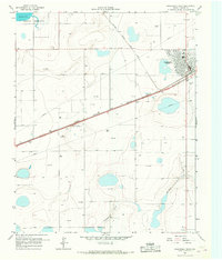
 1953 Pomeroy1954 Print · USGSThe Texas Panhandle ranching country of the early 1950s is captured here as the era of radio and expanded rail lines reshaped the plains. Researchers can trace the dual rail corridors of the Chicago Rock Island and Pacific and Panhandle and Santa Fe past Masterson and Rockwell Lake.2 unique versions available
 - 1953 Map of McBride, 1955 Print
 1953 McBride1955 Print · USGSThe Texas Panhandle's energy and ranching landscapes converge in the early fifties as petroleum infrastructure expands across the plains. Genealogists and historians can trace industrial settlements like Burnett Camp and the rail stop at Mc Bride near the 6666 Ranch.2 unique versions available
 - 1953 Map of Phillips, 1955 Print
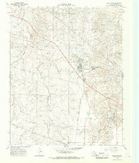
 1953 Phillips1955 Print · USGSThe Texas Panhandle oil boom is in full swing on this mid-century survey of the Borger Oil Field. Local researchers can trace industrial sites like the Refinery and Texroy, or find family roots at Phillips Camp and Haile Ch.
 - 1953 Map of Sevenmile Basin, 1955 Print
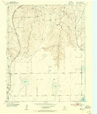
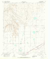
 1953 Sevenmile Basin1955 Print · USGSThe Texas Panhandle plains come into focus in the early fifties, showing a landscape defined by natural depressions and the Panhandle and Santa Fe railroad. Trace the settlement at St Francis and find local landmarks like the Tony Ridge Clubhouse.3 unique versions available
 - 1954 Map of Amarillo, 1966 Print
 1954 Amarillo1966 Print · USGSThe Texas Panhandle in the mid-1960s shows a landscape of rising industrial power and deep-rooted ranching tradition. Local historians can trace the paths of the Panhandle and Santa Fe railroad or locate sites like the Pantex Ordnance Plant and Mobeetie.2 unique versions available
 - 1956 Map of Washburn, 1957 Print
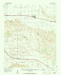
 1956 Washburn1957 Print · USGSThe Texas Panhandle comes alive in the mid-1950s at the vital rail crossing of Washburn, where two major lines met the legendary Route 66. Genealogists and rail historians can trace the local Washburn Cem and the busy junction of the Fort Worth and Denver and the Rock Island railroads.3 unique versions available
 - 1958 Map of Amarillo
 1958 Amarillo1958 Print · USGSThe Texas Panhandle in the mid-1950s reveals a landscape of expanding military installations and oil-rich rail towns. Local historians can trace the development of Amarillo Air Force Base or locate smaller settlements like Magic City and New Mobeetie.
 - 1960 Map of Claude, 1961 Print
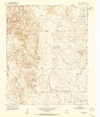
 1960 Claude1961 Print · USGSThe Texas Panhandle cattle country around the 1960s is defined here by the confluence of major railroads and the rugged breaks of the Red River. Trace the path of the Burlington line into Claude or locate landmarks like Conway and Mulberry Creek.2 unique versions available
 - 1960 Map of Groom, 1961 Print
 1960 Groom1961 Print · USGSThe Texas Panhandle plains meet the breaks of the Red River in the 1960s, where ranching culture and rail lines converge. Genealogists and historians can locate family landmarks like the Goodnight Cem and trace cattle operations at Thornberry Ranch or SJ Ranch.
 - 1963 Map of Skellytown, 1968 Print
 1963 Skellytown1968 Print · USGSThe Texas Panhandle industrial landscape comes to life in the early 1960s as petroleum production defines the region. Trace energy history and rail lines through Skellytown, the Carbon Black Plant, and the ATCHISON TOPEKA AND SANTA FE railroad.
 - 1965 Map of White Deer, 1967 Print
 1965 White Deer1967 Print · USGSThe Texas Panhandle town of White Deer appears here during its mid-century industrial peak, centered on the ATCHISON TOPEKA AND SANTA FE railroad. Researchers can locate family sites at Sacred Heart Cem and trace the extensive OIL FIELD surrounding the community.
 - 1965 Map of Abell, 1967 Print
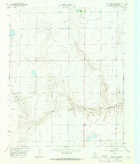
 1965 Abell1967 Print · USGSCarson County's industrial High Plains landscape is captured here in the mid-sixties, dominated by energy extraction and the railroad. Researchers can trace the ATCHISON TOPEKA AND SANTA FE line through Abell and Pomeroy, or locate the Military Reservation near Pantex Lake.
 - 1965 Map of Lake Mc Connell, 1967 Print
 1965 Lake Mc Connell1967 Print · USGSGray County, Texas, was a hub of energy and transport in the mid-1960s as petroleum infrastructure reshaped the Panhandle. Researchers can trace the industrial footprint of the Carbon Black Plant, the residential layout of Kingsmill Camp, and the rail lines of the Atchison Topeka and Santa Fe.
 - 1966 Map of Grandview School, 1967 Print
 1966 Grandview School1967 Print · USGSThe high plains of the Texas Panhandle are captured here in the mid-sixties, straddling the Carson Co and Gray Co line. Local historians and researchers can locate Grandview Sch, trace the path of McClellan Creek, and identify early Oil Wells.
 - 1966 Map of Panhandle West, 1967 Print
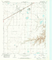
 1966 Panhandle West1967 Print · USGSThe High Plains of Carson County come into focus in the mid-1960s, centered on the rail hub of Panhandle. Genealogists and historians can trace the early township at Lee, locate the landmark Bois d'Arc Tree, and explore the infrastructure of the Military Reservation.
 - 1966 Map of Panhandle East, 1967 Print
 1966 Panhandle East1967 Print · USGSCarson County's high plains economy is on full display in the mid-1960s as the railroad and agricultural industry converge. Trace the rail siding at Panhandle past the Grain Elevator or locate rural landmarks like Heaston and the local Cem.
 - 1966 Map of Cuyler, 1967 Print
 1966 Cuyler1967 Print · USGSCarson County during the mid-sixties reveals a landscape defined by petroleum extraction and rail transport. Researchers can trace the industrial footprint of the Atchison Topeka and Santa Fe line, the silos at Cuyler, and scattered Oil Wells.2 unique versions available
 - 1966 Map of White Deer SW, 1967 Print
 1966 White Deer SW1967 Print · USGSCarson County in the mid-1960s shows a landscape transformed by energy production along the breaks of the High Plains. Genealogists and industrial historians can trace the specific locations of numerous Oil Wells, Gas Wells, and the McClellan Creek drainage system.
 - 1966 Map of Kingsmill, 1967 Print
 1966 Kingsmill1967 Print · USGSThe Texas Panhandle's energy and rail landscape is on full display in the mid-sixties, from the Kingsmill rail stop to the Oil Field operations. Trace the industrial footprint of the Chemical Plant, the Pampa Plant (Gas), and the rail-side Kingsmill Camp.
 - 1970 Map of Phillips, 1973 Print
 1970 Phillips1973 Print · USGSHutchinson County at the height of the Texas oil boom reveals a landscape transformed by extraction and industry. Follow the development of the company town of Phillips and trace historical land use through Haile Ch, the Borger Oil Field, and Spring Creek Sch.2 unique versions available
 - 1971 Map of Skellytown NW, 1973 Print
 1971 Skellytown NW1973 Print · USGSThe Texas Panhandle comes into sharp focus during the early 1970s, revealing a landscape defined by ranching and the oil industry. Researchers can trace family-named locales like Pacher and Meadows or locate specific industrial sites such as Jims Lake and various Oil Wells.
 - 1971 Map of Skellytown NE, 1974 Print
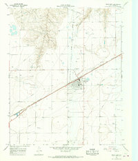
 1971 Skellytown NE1974 Print · USGSThe Texas Panhandle reveals its ranching and energy foundations in the early 1970s across this Roberts County landscape. Genealogists and historians can trace family land at Price Ranch and Hayhook Ranch, or locate water infrastructure like the Jog Section Windmill.
Showing maps 1-25 of 146
Top cities of Carson County
Frequently asked questions
- What are the different types of historical maps available for Carson County?
- What is the oldest map of Carson County?
- Where can I purchase historical maps of Carson County for my home or office?
- Where can I download high-res historical maps of Carson County?
- Are there historical topographic maps available for Carson County?
- Is there historical aerial imagery available for Carson County?
- Where are historical maps of Carson County sourced from?