
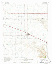
1960 Map of Claude
USGS Topo · Published 1961About this map
Claude serves as the focal point of this 1960s study of the Texas Panhandle, positioned where the Fort Worth and Denver and Burlington rail lines converge. The landscape is defined by the transition from the level High Plains into the deeply eroded breaks of the Salt Fork Red River and Mulberry Creek. Numerous depressions and small intermittent lakes pockmark the surface, revealing a topography shaped by wind and water before modern drainage alterations.
Find a feature on this map
13 named features on this map. Tap any name to fly to it.
Don’t see what you’re looking for? This feature index may not catch every label — zoom into the map to look around manually.
Map Details
Editions of this 1960 Claude Map
2 editions found
Other maps of this area

1953 · Sevenmile Basin
USGS Topo · 1:24,000

1954 · Amarillo
USGS Topo · 1:250,000

1954 · Plainview
USGS Topo · 1:250,000

1956 · Washburn
USGS Topo · 1:24,000

1958 · Amarillo
USGS Topo · 1:250,000

1958 · Plainview
USGS Topo · 1:250,000

1960 · Fairview
USGS Topo · 1:24,000

1960 · Groom
USGS Topo · 1:62,500

1960 · Wayside
USGS Topo · 1:62,500

1963 · Blue Hole Springs
USGS Topo · 1:24,000