1960s Maps of Childress County, Texas
Explore 12 historic maps of Childress County from the 1960s. These maps offer a rare glimpse into what life looked like during the 1960s — showing old roads, neighborhoods, homes, and landmarks that have changed or disappeared over time.
Whether you're researching your family's past, planning a metal detecting trip, or studying how Childress County's landscape evolved across the 1960s, these high-resolution maps are a powerful tool for exploring the history of this region.
- Focus on a specific era: All maps on this page are from the 1960s, giving you a focused view of this time period.
- See what’s changed: Compare century-old streets, trails, and buildings to today's modern landscape using overlays and satellite layers.
- Research with precision: Use these maps for genealogy, historical research, land use analysis, or educational projects.
- View, download, or print: Maps are fully viewable online in high resolution, and can be downloaded or printed for your own records.
Start exploring Childress County's history through authentic maps from the 1960s. This is your window into the past.
Childress County, TX maps
(12)- 1960 Map of Goodlett, 1962 Print
 1960 Goodlett1962 Print · USGSHardeman County at the dawn of the 1960s was a landscape defined by the Red River and a busy network of converging rail lines. Researchers can trace the layouts of small communities like Goodlett and Punkin Center or locate rural burial grounds including Elba Cem and Johnson Cem.2 unique versions available
 - 1960 Map of Loco, 1962 Print
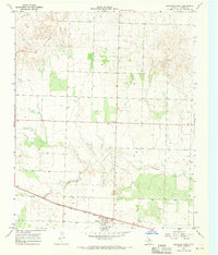
 1960 Loco1962 Print · USGSChildress and Collingsworth counties are captured here in the early sixties, as the cattle and cotton country straddles the Oklahoma border. Researchers can trace rural lineages through the Loco Cem, find former school sites like Garden Valley Sch, or follow the Fort Worth and Denver rail line.
 - 1961 Map of Estelline, 1963 Print
 1961 Estelline1963 Print · USGSThe Texas Panhandle's rail-and-river landscape comes alive in this early 1960s survey of the Hall and Childress county lines. Genealogists and historians can trace the foundations of Estelline and Newlin, locating Estelline Cem and Harrell Chapel.2 unique versions available
 - 1961 Map of Hollis, 1963 Print
 1961 Hollis1963 Print · USGSHarmon County, Oklahoma, in the early sixties showcases a landscape defined by the Prairie Dog Town Fork Red River and the arrival of modern infrastructure. Researchers can locate family landmarks like Bitter Creek Cem, Antioch Ch, and the local Drive-in Theater in Hollis.
 - 1967 Map of Buckle L Ranch, 1969 Print
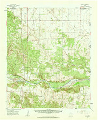
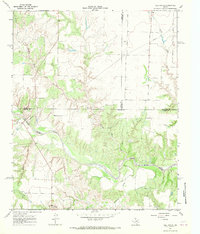
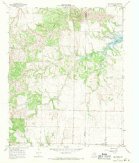
 1967 Buckle L Ranch1969 Print · USGSChildress and Cottle Counties are captured in the late sixties as the ranching landscape of the Rolling Plains met industrial development. Researchers can trace the winding North Pease River and locate remote landmarks like Buckle L Ranch and Deadman Cave.2 unique versions available
 - 1967 Map of Tell South, 1969 Print
 1967 Tell South1969 Print · USGSThe Texas Panhandle at the intersection of three counties shows a landscape defined by the winding North Pease River during the late sixties. Researchers can trace land boundaries and drainage patterns along Running Water Creek and Richland Creek or locate old Gravel Pits.2 unique versions available
 - 1967 Map of Hell Roaring Creek, 1969 Print
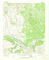
 1967 Hell Roaring Creek1969 Print · USGSThe North Pease River valley at the Childress and Cottle county line is captured here in the late sixties. Genealogists and researchers can trace the intricate drainage of Hell Roaring Creek, Sweetwater Creek, and Devils Creek through this Texas landscape.2 unique versions available
 - 1967 Map of Kirkland South, 1969 Print
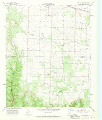 1967 Kirkland South1969 Print · USGSThe West Texas ranch lands of the Panhandle come alive on this late 1960s map of the Childress and Cottle County line. Genealogists can locate the Tennessee Valley Cemetery, while collectors can trace the Fort Worth and Denver and Quanah Acme and Pacific rail lines.2 unique versions available
 - 1967 Map of Kirkland North, 1969 Print
 1967 Kirkland North1969 Print · USGSThe Texas Panhandle's rural landscape is captured here in the late sixties, centered on the railroad-aligned community of Kirkland. Researchers can trace the path of the Fort Worth and Denver line and locate the Kirkland Cem or the local Community Center.2 unique versions available
 - 1967 Map of Tell North, 1969 Print
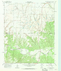
 1967 Tell North1969 Print · USGSAcross the Hall and Childress county line in the late 1960s, this survey captures the rural ranching landscape surrounding Tell. Researchers can locate the community cemetery and trace the winding courses of North Baylor Creek and Baylor Lake.2 unique versions available
 - 1967 Map of Childress, 1969 Print
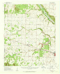
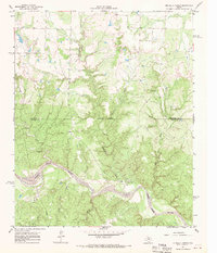
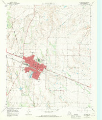 1967 Childress1969 Print · USGSChildress flourished as a railroad and highway crossroads in the Texas Panhandle during the late sixties. Genealogists and historians can locate specific neighborhood landmarks like East Ward Sch, the local Cemetery, and the Fort Worth and Denver line.2 unique versions available
 - 1967 Map of Carey, 1970 Print
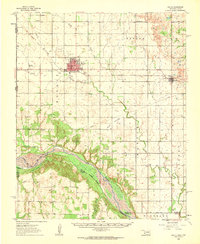
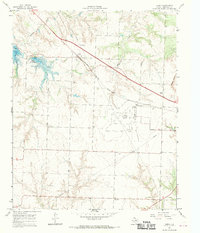 1967 Carey1970 Print · USGSPanhandle ranching and rail travel intersect in Childress County during the late sixties. Genealogists and local historians can trace the Carey settlement, the Carey Cem, and mid-century landmarks like the Drive-in Theater and Baylor Lake.2 unique versions available
End of results
Showing maps 1-12 of 12
Top cities of Childress County
Frequently asked questions
- What are the different types of historical maps available for Childress County?
- What is the oldest map of Childress County?
- Where can I purchase historical maps of Childress County for my home or office?
- Where can I download high-res historical maps of Childress County?
- Are there historical topographic maps available for Childress County?
- Is there historical aerial imagery available for Childress County?
- Where are historical maps of Childress County sourced from?