Old Maps of Childress County, Texas for Genealogy
Trace your family roots with 127 historic maps of Childress County. These high-res maps reveal old neighborhoods, homesites, landmarks, and streets — helping you uncover where your ancestors lived and how the area evolved over time.
- Explore historic neighborhoods: Identify where your relatives may have lived in the 1800s or 1900s.
- Compare maps over time: Trace the changes in streets, buildings, and landmarks for multi-generational research.
- Perfect for genealogy & ancestry research: Used by family historians and researchers to map out lineage and migration.
These maps are an incredible resource for exploring your personal connection to Childress County's past.
Childress County, TX maps
(127)- 1954 Map of Plainview, 1966 Print
 1954 Plainview1966 Print · USGSThe Texas Panhandle and the rugged Caprock Escarpment appear in detail as the region's agricultural and rail networks reached their mid-century peak. Trace family roots and old land patterns through the canyons and plains near Plainview, Palo Duro State Park, and Childress.3 unique versions available
 - 1955 Map of Lawton, 1958 Print
 1955 Lawton1958 Print · USGSSouthwestern Oklahoma and North Texas are shown here in the mid-fifties, dominated by the Wichita Mountains and the vital Red River watershed. Genealogists and historians can trace the foundations of Lawton alongside rural landmarks like Rainy Mountain Church and Pleasant Hill School.5 unique versions available
 - 1958 Map of Plainview
 1958 Plainview1958 Print · USGSThe High Plains and Caprock Escarpment meet in the late fifties, showcasing the ranching and rail networks of the Texas Panhandle. Trace family roots and vanished stops along the Panhandle and Santa Fe railroad through Plainview, Silverton, and Matador.
 - 1960 Map of Goodlett, 1962 Print
 1960 Goodlett1962 Print · USGSHardeman County at the dawn of the 1960s was a landscape defined by the Red River and a busy network of converging rail lines. Researchers can trace the layouts of small communities like Goodlett and Punkin Center or locate rural burial grounds including Elba Cem and Johnson Cem.2 unique versions available
 - 1960 Map of Loco, 1962 Print
 1960 Loco1962 Print · USGSChildress and Collingsworth counties are captured here in the early sixties, as the cattle and cotton country straddles the Oklahoma border. Researchers can trace rural lineages through the Loco Cem, find former school sites like Garden Valley Sch, or follow the Fort Worth and Denver rail line.
 - 1961 Map of Estelline, 1963 Print
 1961 Estelline1963 Print · USGSThe Texas Panhandle's rail-and-river landscape comes alive in this early 1960s survey of the Hall and Childress county lines. Genealogists and historians can trace the foundations of Estelline and Newlin, locating Estelline Cem and Harrell Chapel.2 unique versions available
 - 1961 Map of Hollis, 1963 Print
 1961 Hollis1963 Print · USGSHarmon County, Oklahoma, in the early sixties showcases a landscape defined by the Prairie Dog Town Fork Red River and the arrival of modern infrastructure. Researchers can locate family landmarks like Bitter Creek Cem, Antioch Ch, and the local Drive-in Theater in Hollis.
 - 1967 Map of Buckle L Ranch, 1969 Print
 1967 Buckle L Ranch1969 Print · USGSChildress and Cottle Counties are captured in the late sixties as the ranching landscape of the Rolling Plains met industrial development. Researchers can trace the winding North Pease River and locate remote landmarks like Buckle L Ranch and Deadman Cave.2 unique versions available
 - 1967 Map of Tell South, 1969 Print
 1967 Tell South1969 Print · USGSThe Texas Panhandle at the intersection of three counties shows a landscape defined by the winding North Pease River during the late sixties. Researchers can trace land boundaries and drainage patterns along Running Water Creek and Richland Creek or locate old Gravel Pits.2 unique versions available
 - 1967 Map of Hell Roaring Creek, 1969 Print
 1967 Hell Roaring Creek1969 Print · USGSThe North Pease River valley at the Childress and Cottle county line is captured here in the late sixties. Genealogists and researchers can trace the intricate drainage of Hell Roaring Creek, Sweetwater Creek, and Devils Creek through this Texas landscape.2 unique versions available
 - 1967 Map of Kirkland South, 1969 Print
 1967 Kirkland South1969 Print · USGSThe West Texas ranch lands of the Panhandle come alive on this late 1960s map of the Childress and Cottle County line. Genealogists can locate the Tennessee Valley Cemetery, while collectors can trace the Fort Worth and Denver and Quanah Acme and Pacific rail lines.2 unique versions available
 - 1967 Map of Kirkland North, 1969 Print
 1967 Kirkland North1969 Print · USGSThe Texas Panhandle's rural landscape is captured here in the late sixties, centered on the railroad-aligned community of Kirkland. Researchers can trace the path of the Fort Worth and Denver line and locate the Kirkland Cem or the local Community Center.2 unique versions available
 - 1967 Map of Tell North, 1969 Print
 1967 Tell North1969 Print · USGSAcross the Hall and Childress county line in the late 1960s, this survey captures the rural ranching landscape surrounding Tell. Researchers can locate the community cemetery and trace the winding courses of North Baylor Creek and Baylor Lake.2 unique versions available
 - 1967 Map of Childress, 1969 Print
 1967 Childress1969 Print · USGSChildress flourished as a railroad and highway crossroads in the Texas Panhandle during the late sixties. Genealogists and historians can locate specific neighborhood landmarks like East Ward Sch, the local Cemetery, and the Fort Worth and Denver line.2 unique versions available
 - 1967 Map of Carey, 1970 Print
 1967 Carey1970 Print · USGSPanhandle ranching and rail travel intersect in Childress County during the late sixties. Genealogists and local historians can trace the Carey settlement, the Carey Cem, and mid-century landmarks like the Drive-in Theater and Baylor Lake.2 unique versions available
 - 1984 Map of Arlie, 1985 Print
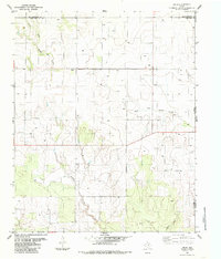 1984 Arlie1985 Print · USGSThe Texas Panhandle's eastern edge is captured here in the early 1980s, documenting a landscape of rural water wells and county line roads. Genealogists can locate the small settlement of Arlie and trace the winding paths of Settlers Creek and West Fork Sandy Creek.
 - 1984 Map of Goodlett, 1985 Print
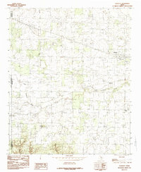 1984 Goodlett1985 Print · USGSHardeman County in the late seventies is captured here at the transition between the rolling plains and the rugged breaks. Genealogists can trace the rural layouts of Goodlett, Wheatland, and Lazare, while exploring local landmarks like Hepsidam Hill.
 - 1984 Map of Willams, 1985 Print
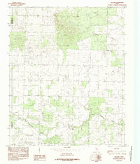 1984 Willams1985 Print · USGSThe Texas Panhandle borderlands are captured here in the late 1970s, showing the rural landscape around the settlement of Williams. Genealogists and local historians can trace the creek-side terrain of North Groesbeck Creek and Tepee Creek as it crosses from Hardeman Co into Childress Co.
 - 1984 Map of Estelline NE, 1985 Print
 1984 Estelline NE1985 Print · USGSThe Texas Panhandle breaks come into focus in the mid-1980s, revealing a landscape defined by ranching and regional watersheds. Researchers can trace the winding paths of Wet Salt Creek and Horse Creek, alongside scattered Corrals and industrial Gravel Pits.
 - 1984 Map of Loco, 1985 Print
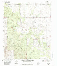 1984 Loco1985 Print · USGSChildress and Collingsworth Counties are captured here in the early eighties as ranching and rail interests defined the local landscape. Researchers can trace the Burlington Northern railroad through Loco or locate family roots at the Loco Cem near Buck Creek.
 - 1984 Map of Estelline NW, 1985 Print
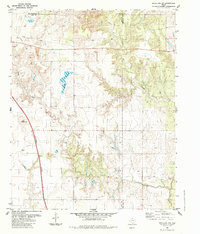 1984 Estelline NW1985 Print · USGSThe Texas Panhandle ranchlands appear in transition during the mid-1980s, where Hall, Childress, and Collingsworth counties meet. Researchers can trace the path of the Burlington Northern railroad or locate water sources like Bryants Lake and several working corrals.
 - 1985 Map of Garden Valley
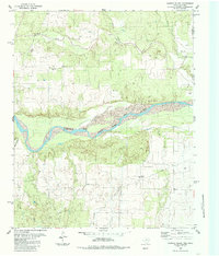 1985 Garden Valley1985 Print · USGSThe Texas-Oklahoma borderlands come into focus in the mid-1980s, centered on the broad path of the Prairie Dog Town Fork Red River. Researchers can trace the rural landscape of Childress County through landmarks like Garden Valley, the Olympus Cem, and Settlers Creek.
 - 1985 Map of Estelline SE
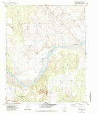 1985 Estelline SE1985 Print · USGSChildress County in the mid-eighties shows a rugged landscape defined by the Prairie Dog Town Fork Red River. Genealogists and historians can trace the BURLINGTON NORTHERN rail line and locate remote landmarks like the LANDING STRIP and Corral.
 - 1985 Map of Estelline
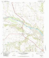 1985 Estelline1985 Print · USGSThe Hall County plains meet the Red River breaks in the mid-1980s as the railroad defines local life. Genealogists can locate Newlin Cem and Cem, while researchers can trace the Burlington Northern tracks through Newlin and Estelline.
 - 1985 Map of Altus
 1985 Altus1985 Print · USGSSouthwestern Oklahoma in the mid-eighties shows a vast agricultural and military landscape shaped by the Red River forks. Trace the intersections of the Atchison Topeka and Santa Fe railroad with rural points like Fairmount Cem and Duke.2 unique versions available
Showing maps 1-25 of 127
Top cities of Childress County
Frequently asked questions
- What are the different types of historical maps available for Childress County?
- What is the oldest map of Childress County?
- Where can I purchase historical maps of Childress County for my home or office?
- Where can I download high-res historical maps of Childress County?
- Are there historical topographic maps available for Childress County?
- Is there historical aerial imagery available for Childress County?
- Where are historical maps of Childress County sourced from?