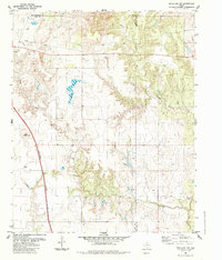
1984 Map of Estelline NW
USGS Topo · Published 1985About this map
The rolling plains of the Texas Panhandle converge at the tri-county corner of Collingsworth, Hall, and Childress counties. This landscape is defined by the ephemeral drainage of Jonah Creek and Dry Salt Creek, which carve intricate patterns into the local topography. Human infrastructure is sparsely but deliberately placed across this cattle-country terrain, marked by a lonely Corral and a functional Water Tank supporting ranching operations. The Burlington Northern railroad cuts a diagonal line across the southwestern corner, serving as the primary industrial link to the region's cattle and cotton markets. Bryants Lake provides a significant water source in an area characterized by scattered wells and buried pipelines, illustrating the ongoing effort to manage water resources in this part of West Texas during the mid-1980s.
Find a feature on this map
10 named features on this map. Tap any name to fly to it.
Don’t see what you’re looking for? This feature index may not catch every label — zoom into the map to look around manually.
Map Details
Editions of this 1984 Estelline NW Map
This is the sole edition of this map. No revisions or reprints were ever made.
Other maps of this area

1954 · Plainview
USGS Topo · 1:250,000

1958 · Plainview
USGS Topo · 1:250,000

1961 · Memphis
USGS Topo · 1:62,500

1961 · Estelline
USGS Topo · 1:62,500

1963 · Giles
USGS Topo · 1:24,000

1964 · Rolla SW
USGS Topo · 1:24,000

1964 · Rolla
USGS Topo · 1:24,000

1976 · Memphis SE
USGS Topo · 1:24,000

1976 · Memphis NE
USGS Topo · 1:24,000

1984 · Estelline NE
USGS Topo · 1:24,000