
1976 Map of Memphis NE
USGS Topo · Published 1978About this map
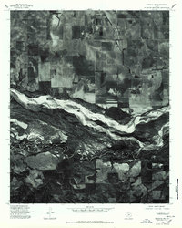
Agricultural patterns and deep-cut drainage basins define this portion of the Texas Panhandle as it appeared in the mid-1970s. The city of Memphis stands as the primary hub of the region, positioned along the rail and highway corridors that cross the northern edge of the sheet. Outside the developed grid of the town, the landscape transitions abruptly between the rectilinear precision of dryland farming and the winding, eroded breaks of the local watercourses. This orthophoto provides a clear look at the historic footprint of Memphis during a period of agricultural stability, showing the relationship between the town and the surrounding fields that fueled its economy.
Find a feature on this map
1 named feature on this map. Tap any name to fly to it.
Don’t see what you’re looking for? This feature index may not catch every label — zoom into the map to look around manually.
Map Details
Editions of this 1976 Memphis NE Map
This is the sole edition of this map. No revisions or reprints were ever made.
Other maps of this area

1954 · Plainview
USGS Topo · 1:250,000

1958 · Plainview
USGS Topo · 1:250,000

1961 · Memphis
USGS Topo · 1:62,500

1961 · Estelline
USGS Topo · 1:62,500

1963 · Hedley
USGS Topo · 1:24,000

1963 · Giles
USGS Topo · 1:24,000

1964 · Rolla SW
USGS Topo · 1:24,000

1976 · Memphis NW
USGS Topo · 1:24,000

1976 · Memphis SE
USGS Topo · 1:24,000
1976 · Memphis SW
USGS Topo · 1:24,000