Old Maps of Collingsworth County, Texas
Explore 160 old maps of Collingsworth County, spanning from 1954 to today. These high-resolution historic maps reveal how streets, neighborhoods, landmarks, and natural features evolved over time — perfect for genealogy, metal detecting, research, and local history exploration.
What you can do with these maps:
- See how Collingsworth County changed over time: Compare historical maps to modern-day views to trace roads, homesites, rail lines & more.
- View detailed metadata: Each map includes creators, publishers, year, scale, and archive source.
- Overlay maps with satellite & LiDAR: Visualize the past alongside modern tools to explore terrain & human change.
- Trusted historical sources: Maps sourced from the USGS, Library of Congress, and other archives.
- Access maps your way: View online, download high-res files, or order prints for personal or research use.
Start exploring old maps of Collingsworth County to uncover forgotten places, hidden landmarks, and the deep history beneath your feet.
Collingsworth County, TX maps
(160)- 1954 Map of Amarillo, 1966 Print
 1954 Amarillo1966 Print · USGSThe Texas Panhandle in the mid-1960s shows a landscape of rising industrial power and deep-rooted ranching tradition. Local historians can trace the paths of the Panhandle and Santa Fe railroad or locate sites like the Pantex Ordnance Plant and Mobeetie.2 unique versions available
 - 1954 Map of Plainview, 1966 Print
 1954 Plainview1966 Print · USGSThe Texas Panhandle and the rugged Caprock Escarpment appear in detail as the region's agricultural and rail networks reached their mid-century peak. Trace family roots and old land patterns through the canyons and plains near Plainview, Palo Duro State Park, and Childress.3 unique versions available
 - 1958 Map of Amarillo
 1958 Amarillo1958 Print · USGSThe Texas Panhandle in the mid-1950s reveals a landscape of expanding military installations and oil-rich rail towns. Local historians can trace the development of Amarillo Air Force Base or locate smaller settlements like Magic City and New Mobeetie.
 - 1958 Map of Plainview
 1958 Plainview1958 Print · USGSThe High Plains and Caprock Escarpment meet in the late fifties, showcasing the ranching and rail networks of the Texas Panhandle. Trace family roots and vanished stops along the Panhandle and Santa Fe railroad through Plainview, Silverton, and Matador.
 - 1959 Map of Wellington NW, 1960 Print
 1959 Wellington NW1960 Print · USGSCollingsworth County in the late fifties shows a rural landscape shaped by the Salt Fork Red River. Genealogists and historians can trace the Fort Worth and Denver railroad near Lutie and the Pan Fork summer camp.2 unique versions available
 - 1959 Map of Shinnery Creek, 1960 Print
 1959 Shinnery Creek1960 Print · USGSCollingsworth County sits on the Oklahoma border in the late fifties, where the winding Salt Fork Red River dominates the landscape. Local historians can trace early ranching features like Corral and family landmarks including Hughes and Coon.
 - 1959 Map of Spencer Lake, 1960 Print
 1959 Spencer Lake1960 Print · USGSThe Texas Panhandle ranching country is captured here in the late fifties as it straddles the county line. Trace the drainage patterns of Whitefish Creek and locate family-named landmarks like Corky or the isolated Windmill.
 - 1959 Map of McKnight, 1960 Print
 1959 McKnight1960 Print · USGSDonley and Collingsworth counties are captured here in the late fifties, showing a rural Texas Panhandle landscape shaped by the Salt Fork Red River. Genealogists and local historians can trace the community around Mc Knight and the Ring Ch church.2 unique versions available
 - 1960 Map of Loco, 1962 Print
 1960 Loco1962 Print · USGSChildress and Collingsworth counties are captured here in the early sixties, as the cattle and cotton country straddles the Oklahoma border. Researchers can trace rural lineages through the Loco Cem, find former school sites like Garden Valley Sch, or follow the Fort Worth and Denver rail line.
 - 1961 Map of Memphis, 1963 Print
 1961 Memphis1963 Print · USGSThe Texas Panhandle is captured here in the early sixties as a network of rail-side settlements and wide river basins. Genealogists and local historians can trace the foundations of Memphis or locate rural sites like Plaska, Hulver Cemetery, and the Travis School.
 - 1961 Map of Estelline, 1963 Print
 1961 Estelline1963 Print · USGSThe Texas Panhandle's rail-and-river landscape comes alive in this early 1960s survey of the Hall and Childress county lines. Genealogists and historians can trace the foundations of Estelline and Newlin, locating Estelline Cem and Harrell Chapel.2 unique versions available
 - 1963 Map of Giles, 1966 Print
 1963 Giles1966 Print · USGSDonley County's ranching and rail landscape is meticulously captured here in the early sixties. Genealogists and historians can trace the Fort Worth and Denver railroad through Giles, locate old Gravel Pits, and map family property via historical fence lines.2 unique versions available
 - 1963 Map of Ramsdell, 1967 Print
 1963 Ramsdell1967 Print · USGSThe eastern Texas Panhandle comes alive in the early sixties as a hub of ranching and transcontinental travel. Trace the paths of ranching families at the McMurtry Ranch or follow the historic rail line through Ramsdell to Lake Loraine.
 - 1963 Map of Fulller, 1967 Print
 1963 Fulller1967 Print · USGSWheeler County and the Oklahoma borderlands are captured here in the early sixties, showing the rail and road network of the High Plains. Researchers can trace the Chicago Rock Island and Pacific railroad through Fuller or locate early energy infrastructure like a regional Pipeline.
 - 1963 Map of Shamrock East, 1967 Print
 1963 Shamrock East1967 Print · USGSShamrock and the northern Panhandle are captured here in the early sixties as the oil economy and rail lines defined local life. Genealogists can trace local landmarks like Bethel Ch, the town Cemetery, and the Chicago Rock Island and Pacific railroad.2 unique versions available
 - 1963 Map of Shamrock West, 1967 Print
 1963 Shamrock West1967 Print · USGSThe Texas Panhandle comes into focus in the 1960s as a vital junction of the Fort Worth and Denver and Chicago Rock Island and Pacific railroads. Researchers can trace the layout of Shamrock and rural landmarks like Lela, Lone Mound Ch, and the local Rodeo Grounds.2 unique versions available
 - 1963 Map of McLean, 1967 Print
 1963 McLean1967 Print · USGSMcLean and the surrounding High Plains ranch lands are captured here in the early sixties as the town grew along the Chicago Rock Island and Pacific rail line. Researchers can locate the Hillcrest Cem, trace the local Rodeo Ground, and find long-standing landmarks like the Drive-in Theater.2 unique versions available
 - 1963 Map of Little Wolf Creek, 1967 Print
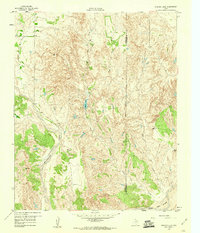
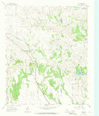
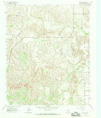
 1963 Little Wolf Creek1967 Print · USGSThe Texas-Oklahoma borderlands in the early 1960s are defined by high plains drainage and isolated ranching outposts. Genealogists and historians can locate the Needwood Cem, trace the remote Jeep Trail, and find landmarks like Antelope Peak or the Lost Creek Ranch.
 - 1964 Map of Rolla SW, 1967 Print
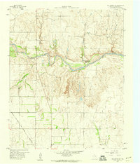
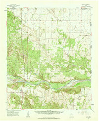
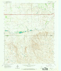
 1964 Rolla SW1967 Print · USGSCollingsworth County's rural landscape is captured here in the mid-1960s, showing the complex drainage systems of the Texas Panhandle. Trace the seasonal flow of Wet Salt Creek and Dry Salt Creek or locate the site of a local Gravel Pit and Buck Creek.
 - 1964 Map of Rolla NE, 1967 Print
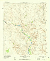
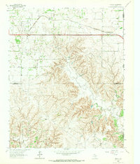
 1964 Rolla NE1967 Print · USGSCollingsworth County ranch land and the Texas Panhandle plains are documented here in the mid-sixties. Researchers can trace the path of the Fort Worth and Denver railroad as it approaches the Salt Fork Red River and Cottonwood Creek.2 unique versions available
 - 1964 Map of Wellington, 1967 Print
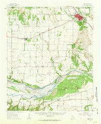
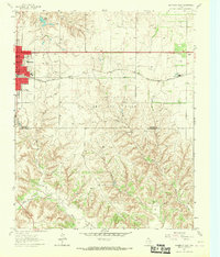
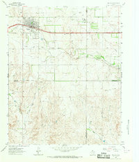
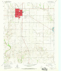 1964 Wellington1967 Print · USGSWellington and the surrounding Texas Panhandle plains are captured in the mid-sixties, showing a community built on the railroad and regional agriculture. Researchers can locate the Courthouse, trace the Fort Worth and Denver line, or find family plots in Old Wellington Cem.2 unique versions available
 - 1964 Map of Quail, 1967 Print
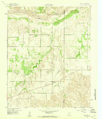
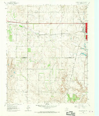
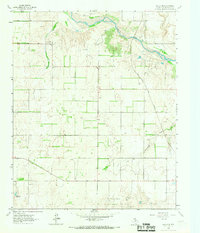
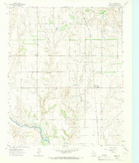
 1964 Quail1967 Print · USGSCollingsworth County agricultural lands are captured here during the mid-1960s, showing the intersection of rural life and wide-open terrain. Genealogists and local historians can locate the Quail Cemetery, the community of Marilla, and the drainage of Dry Hollow.
 - 1964 Map of Dodson, 1967 Print
 1964 Dodson1967 Print · USGSThe community of Dodson sits at the Texas and Oklahoma border in the mid-1960s, where the high plains meet the river breaks. Genealogists can trace family locations near Dodson Cem, Kelley Ch, and the remnants of the Old RR Grade.
 - 1964 Map of Abra, 1967 Print
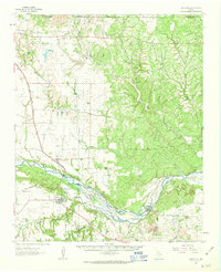
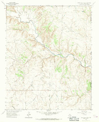
 1964 Abra1967 Print · USGSIn the Texas panhandle during the mid-1960s, the riverbed of the Salt Fork Red River dominated the local terrain. Genealogists and historians can locate ranching landmarks like Hook Ranch and Mc Murtry Windmill alongside the small community of Abra.
 - 1964 Map of Dozier, 1967 Print
 1964 Dozier1967 Print · USGSCollingsworth County in the mid-1960s was a landscape of Panhandle prairie defined by the Salt Fork Red River and a growing energy economy. Genealogists and local historians can trace family roots at Dozier Cem and Plymouth Cem near the rail lines of the Fort Worth and Denver.
Showing maps 1-25 of 160
Top cities of Collingsworth County
Frequently asked questions
- What are the different types of historical maps available for Collingsworth County?
- What is the oldest map of Collingsworth County?
- Where can I purchase historical maps of Collingsworth County for my home or office?
- Where can I download high-res historical maps of Collingsworth County?
- Are there historical topographic maps available for Collingsworth County?
- Is there historical aerial imagery available for Collingsworth County?
- Where are historical maps of Collingsworth County sourced from?