
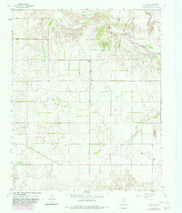
1964 Map of Rolla NE
USGS Topo · Published 1967About this map
The Salt Fork Red River carves through the northern reaches of this Collingsworth County landscape, defining the local drainage patterns as it flows southeast. The mid-1960s terrain is characterized by broad agricultural fields and ranch land, segmented by fine fence lines and dotted with occasional industrial activity. Evidence of local extraction is visible in the form of a Quarry and a Gravel Pit, while a significant Spillway Elev 2166 suggests water management efforts in this semi-arid region. Transportation and commerce are anchored by the Fort Worth and Denver railroad line, which cuts a straight path across the plains toward the river. Smaller seasonal waterways like Cottonwood Creek weave through the southern portion of the quadrangle, illustrating the natural geography that influenced early Texas Panhandle land use.
Find a feature on this map
7 named features on this map. Tap any name to fly to it.
Don’t see what you’re looking for? This feature index may not catch every label — zoom into the map to look around manually.
Map Details
Editions of this 1964 Rolla NE Map
2 editions found
Other maps of this area

1954 · Amarillo
USGS Topo · 1:250,000

1954 · Plainview
USGS Topo · 1:250,000

1958 · Amarillo
USGS Topo · 1:250,000

1958 · Plainview
USGS Topo · 1:250,000

1959 · Wellington NW
USGS Topo · 1:24,000

1964 · Rolla SW
USGS Topo · 1:24,000

1964 · Wellington
USGS Topo · 1:24,000

1964 · Quail
USGS Topo · 1:24,000
1964 · Abra
USGS Topo · 1:24,000
1964 · Dozier
USGS Topo · 1:24,000