
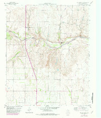
1959 Map of Wellington NW
USGS Topo · Published 1960About this map
The Salt Fork Red River carves a winding path through this Texas Panhandle landscape, where the sandy riverbed and adjacent floodplains define the regional topography. Near the river, the Pan Fork (Summer Camp) occupies a sheltered bend, while industrial activity is noted by several Gravel Pits along the banks. Further south, the Fort Worth and Denver (Burlington) railroad cuts diagonally across the terrain, serving as a primary transit artery through Collingsworth County. Small settlements and ranching outposts like Lutie and Branson are linked by a network of unimproved roads and light-duty paths that navigate the various drainage systems, including Lutie Creek and Cottonwood Creek. The map illustrates a rural economy reliant on the interplay between the rail line and the natural watercourses during the late 1950s.
Find a feature on this map
11 named features on this map. Tap any name to fly to it.
Don’t see what you’re looking for? This feature index may not catch every label — zoom into the map to look around manually.
Map Details
Editions of this 1959 Wellington NW Map
2 editions found
Other maps of this area

1954 · Amarillo
USGS Topo · 1:250,000

1954 · Plainview
USGS Topo · 1:250,000

1958 · Amarillo
USGS Topo · 1:250,000

1958 · Plainview
USGS Topo · 1:250,000

1959 · Shinnery Creek
USGS Topo · 1:24,000

1963 · Little Wolf Creek
USGS Topo · 1:24,000

1964 · Rolla NE
USGS Topo · 1:24,000

1964 · Wellington
USGS Topo · 1:24,000

1964 · Dodson
USGS Topo · 1:24,000
1964 · Dozier
USGS Topo · 1:24,000