1980s Maps of Collingsworth County, Texas
Explore 7 historic maps of Collingsworth County from the 1980s. These maps offer a rare glimpse into what life looked like during the 1980s — showing old roads, neighborhoods, homes, and landmarks that have changed or disappeared over time.
Whether you're researching your family's past, planning a metal detecting trip, or studying how Collingsworth County's landscape evolved across the 1980s, these high-resolution maps are a powerful tool for exploring the history of this region.
- Focus on a specific era: All maps on this page are from the 1980s, giving you a focused view of this time period.
- See what’s changed: Compare century-old streets, trails, and buildings to today's modern landscape using overlays and satellite layers.
- Research with precision: Use these maps for genealogy, historical research, land use analysis, or educational projects.
- View, download, or print: Maps are fully viewable online in high resolution, and can be downloaded or printed for your own records.
Start exploring Collingsworth County's history through authentic maps from the 1980s. This is your window into the past.
Collingsworth County, TX maps
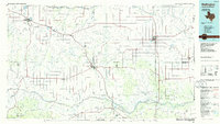
(7)- 1983 Map of Shamrock
 1983 Shamrock1983 Print · USGSThe Texas Panhandle in the early 1980s reveals a landscape shaped by petroleum and the rail lines of the southern plains. Genealogists and historians can trace the Chicago Rock Island and Pacific corridor through Mc Lean and Shamrock, or locate smaller centers like Magic City and Lefors.
 - 1984 Map of Arlie, 1985 Print
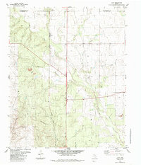
 1984 Arlie1985 Print · USGSThe Texas Panhandle's eastern edge is captured here in the early 1980s, documenting a landscape of rural water wells and county line roads. Genealogists can locate the small settlement of Arlie and trace the winding paths of Settlers Creek and West Fork Sandy Creek.
 - 1984 Map of Estelline NE, 1985 Print
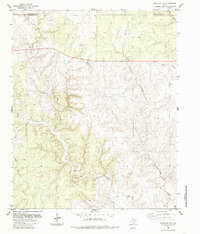 1984 Estelline NE1985 Print · USGSThe Texas Panhandle breaks come into focus in the mid-1980s, revealing a landscape defined by ranching and regional watersheds. Researchers can trace the winding paths of Wet Salt Creek and Horse Creek, alongside scattered Corrals and industrial Gravel Pits.
 - 1984 Map of Loco, 1985 Print
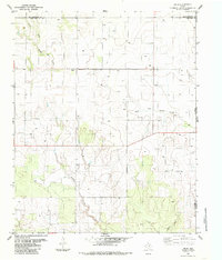
 1984 Loco1985 Print · USGSChildress and Collingsworth Counties are captured here in the early eighties as ranching and rail interests defined the local landscape. Researchers can trace the Burlington Northern railroad through Loco or locate family roots at the Loco Cem near Buck Creek.
 - 1984 Map of Estelline NW, 1985 Print
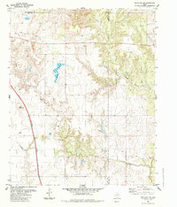 1984 Estelline NW1985 Print · USGSThe Texas Panhandle ranchlands appear in transition during the mid-1980s, where Hall, Childress, and Collingsworth counties meet. Researchers can trace the path of the Burlington Northern railroad or locate water sources like Bryants Lake and several working corrals.
 - 1985 Map of Memphis
 1985 Memphis1985 Print · USGSThe Texas Panhandle town of Memphis is captured here in the mid-eighties, showing the intersection of ranching life and town infrastructure. Genealogists and local historians can locate several Cem sites, the Municipal Airport, and the site of a Drive-In Theater.
 - 1986 Map of Wellington
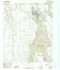
 1986 Wellington1986 Print · USGSThe Texas Panhandle in the 1980s shows a landscape of cattle ranching and rail-dependent towns along the Burlington Northern. Trace family history and local industry through locations like the Citizens Cem, Greenbelt Reservoir, and Mc Knight.2 unique versions available
End of results
Showing maps 1-7 of 7
Top cities of Collingsworth County
Frequently asked questions
- What are the different types of historical maps available for Collingsworth County?
- What is the oldest map of Collingsworth County?
- Where can I purchase historical maps of Collingsworth County for my home or office?
- Where can I download high-res historical maps of Collingsworth County?
- Are there historical topographic maps available for Collingsworth County?
- Is there historical aerial imagery available for Collingsworth County?
- Where are historical maps of Collingsworth County sourced from?