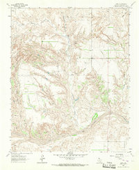
1964 Map of Abra
USGS Topo · Published 1967About this map
The Salt Fork Red River snakes through the southern portion of this landscape, its wide, braided bed defining the local topography. This 1960s survey captures a transition in rural Collingsworth County as traditional ranching and farming infrastructure exists alongside emerging energy extraction. Scattered settlements like Abra and Hess serve as anchors in a region defined by extensive drainage systems including Richardson Creek, Wills Creek, and Big Sandy Creek.
Find a feature on this map
13 named features on this map. Tap any name to fly to it.
Don’t see what you’re looking for? This feature index may not catch every label — zoom into the map to look around manually.
Map Details
Editions of this 1964 Abra Map
This is the sole edition of this map. No revisions or reprints were ever made.
Other maps of this area

1954 · Amarillo
USGS Topo · 1:250,000

1954 · Plainview
USGS Topo · 1:250,000

1958 · Amarillo
USGS Topo · 1:250,000

1958 · Plainview
USGS Topo · 1:250,000

1959 · Spencer Lake
USGS Topo · 1:24,000

1959 · McKnight
USGS Topo · 1:24,000

1963 · Ramsdell
USGS Topo · 1:24,000

1963 · Shamrock West
USGS Topo · 1:24,000

1963 · McLean
USGS Topo · 1:24,000

1964 · Rolla NE
USGS Topo · 1:24,000