
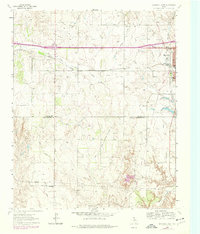
1963 Map of Shamrock West
USGS Topo · Published 1967About this map
The intersection of the Fort Worth and Denver and the Chicago Rock Island and Pacific railroads defines the western periphery of Shamrock in the early 1960s. This survey captures a landscape of the Texas Panhandle transitioning from town centers into open ranch land and prairie, marked by the administrative boundary between Wheeler Co and Collingsworth Co. The presence of the Rodeo Grounds and a Golf Course near the town core suggests the social centers of the era, while outlying landmarks like the Lone Mound Ch and Lone Mound serve as anchors for the rural community. The terrain is deeply dissected by numerous watercourses, including Dry Long Creek and Dozier Creek, which shaped the early road and rail alignments. Notable local infrastructure such as the South Ward Sch and scattered Gravel Pit operations highlight the development patterns of Wheeler County at mid-century.
Find a feature on this map
19 named features on this map. Tap any name to fly to it.
Don’t see what you’re looking for? This feature index may not catch every label — zoom into the map to look around manually.
Map Details
Editions of this 1963 Shamrock West Map
2 editions found
Other maps of this area

1954 · Amarillo
USGS Topo · 1:250,000

1958 · Amarillo
USGS Topo · 1:250,000

1962 · Twitty
USGS Topo · 1:24,000

1962 · Wheeler SE
USGS Topo · 1:24,000

1962 · Pakan
USGS Topo · 1:24,000

1963 · Ramsdell
USGS Topo · 1:24,000

1963 · Shamrock East
USGS Topo · 1:24,000
1964 · Abra
USGS Topo · 1:24,000
1964 · Dozier
USGS Topo · 1:24,000
1964 · Lutie
USGS Topo · 1:24,000