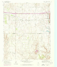
1963 Map of Shamrock West
USGS Topo · Published 1978About this map
Shamrock sits at the eastern edge of this Panhandle landscape, where the iconic route 66 meets the modern path of Interstate 40. This 1963 survey, updated in the late 1970s, captures the town's structural evolution including the South Ward Sch and the local Golf Course. To the west, the small settlement of Lela is situated along the Chicago Rock Island and Pacific railroad, which parallels the highway corridor.
Find a feature on this map
22 named features on this map. Tap any name to fly to it.
Don’t see what you’re looking for? This feature index may not catch every label — zoom into the map to look around manually.
Map Details
Editions of this 1963 Shamrock West Map
2 editions found
Other maps of this area

1954 · Amarillo
USGS Topo · 1:250,000

1958 · Amarillo
USGS Topo · 1:250,000

1962 · Twitty
USGS Topo · 1:24,000

1962 · Wheeler SE
USGS Topo · 1:24,000

1962 · Pakan
USGS Topo · 1:24,000

1963 · Ramsdell
USGS Topo · 1:24,000

1963 · Shamrock East
USGS Topo · 1:24,000

1963 · Shamrock West
USGS Topo · 1:24,000
1964 · Abra
USGS Topo · 1:24,000
1964 · Dozier
USGS Topo · 1:24,000