1980s Maps of Childress County, Texas
Explore 15 historic maps of Childress County from the 1980s. These maps offer a rare glimpse into what life looked like during the 1980s — showing old roads, neighborhoods, homes, and landmarks that have changed or disappeared over time.
Whether you're researching your family's past, planning a metal detecting trip, or studying how Childress County's landscape evolved across the 1980s, these high-resolution maps are a powerful tool for exploring the history of this region.
- Focus on a specific era: All maps on this page are from the 1980s, giving you a focused view of this time period.
- See what’s changed: Compare century-old streets, trails, and buildings to today's modern landscape using overlays and satellite layers.
- Research with precision: Use these maps for genealogy, historical research, land use analysis, or educational projects.
- View, download, or print: Maps are fully viewable online in high resolution, and can be downloaded or printed for your own records.
Start exploring Childress County's history through authentic maps from the 1980s. This is your window into the past.
Childress County, TX maps
(15)- 1984 Map of Arlie, 1985 Print
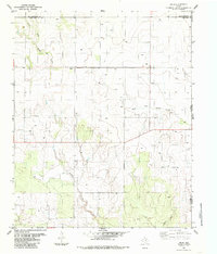 1984 Arlie1985 Print · USGSThe Texas Panhandle's eastern edge is captured here in the early 1980s, documenting a landscape of rural water wells and county line roads. Genealogists can locate the small settlement of Arlie and trace the winding paths of Settlers Creek and West Fork Sandy Creek.
 - 1984 Map of Goodlett, 1985 Print
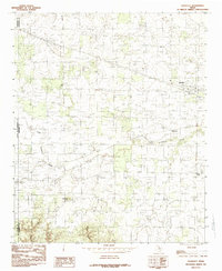 1984 Goodlett1985 Print · USGSHardeman County in the late seventies is captured here at the transition between the rolling plains and the rugged breaks. Genealogists can trace the rural layouts of Goodlett, Wheatland, and Lazare, while exploring local landmarks like Hepsidam Hill.
 - 1984 Map of Willams, 1985 Print
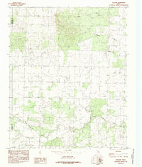 1984 Willams1985 Print · USGSThe Texas Panhandle borderlands are captured here in the late 1970s, showing the rural landscape around the settlement of Williams. Genealogists and local historians can trace the creek-side terrain of North Groesbeck Creek and Tepee Creek as it crosses from Hardeman Co into Childress Co.
 - 1984 Map of Estelline NE, 1985 Print
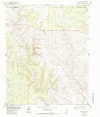 1984 Estelline NE1985 Print · USGSThe Texas Panhandle breaks come into focus in the mid-1980s, revealing a landscape defined by ranching and regional watersheds. Researchers can trace the winding paths of Wet Salt Creek and Horse Creek, alongside scattered Corrals and industrial Gravel Pits.
 - 1984 Map of Loco, 1985 Print
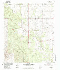 1984 Loco1985 Print · USGSChildress and Collingsworth Counties are captured here in the early eighties as ranching and rail interests defined the local landscape. Researchers can trace the Burlington Northern railroad through Loco or locate family roots at the Loco Cem near Buck Creek.
 - 1984 Map of Estelline NW, 1985 Print
 1984 Estelline NW1985 Print · USGSThe Texas Panhandle ranchlands appear in transition during the mid-1980s, where Hall, Childress, and Collingsworth counties meet. Researchers can trace the path of the Burlington Northern railroad or locate water sources like Bryants Lake and several working corrals.
 - 1985 Map of Garden Valley
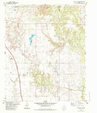
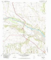
 1985 Garden Valley1985 Print · USGSThe Texas-Oklahoma borderlands come into focus in the mid-1980s, centered on the broad path of the Prairie Dog Town Fork Red River. Researchers can trace the rural landscape of Childress County through landmarks like Garden Valley, the Olympus Cem, and Settlers Creek.
 - 1985 Map of Estelline SE
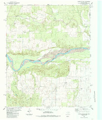
 1985 Estelline SE1985 Print · USGSChildress County in the mid-eighties shows a rugged landscape defined by the Prairie Dog Town Fork Red River. Genealogists and historians can trace the BURLINGTON NORTHERN rail line and locate remote landmarks like the LANDING STRIP and Corral.
 - 1985 Map of Estelline
 1985 Estelline1985 Print · USGSThe Hall County plains meet the Red River breaks in the mid-1980s as the railroad defines local life. Genealogists can locate Newlin Cem and Cem, while researchers can trace the Burlington Northern tracks through Newlin and Estelline.
 - 1985 Map of Altus
 1985 Altus1985 Print · USGSSouthwestern Oklahoma in the mid-eighties shows a vast agricultural and military landscape shaped by the Red River forks. Trace the intersections of the Atchison Topeka and Santa Fe railroad with rural points like Fairmount Cem and Duke.2 unique versions available
 - 1985 Map of Smithdale
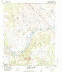
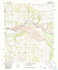
 1985 Smithdale1985 Print · USGSChildress County in the mid-1980s is defined by the wide, sandy expanse of the Prairie Dog Town Fork Red River. Researchers can trace the path of the Burlington Northern railroad past the settlements of Smithdale and Conkling.
 - 1985 Map of Hollis SW
 1985 Hollis SW1985 Print · USGSThe Oklahoma and Texas state line meets at the confluence of the Red River in the mid-1980s. Genealogists and local historians can locate Halsmith Cemetery, Hooleyan Church, and the winding path of the Prairie Dog Town Fork Red River.
 - 1986 Map of Childress
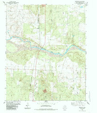
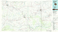
 1986 Childress1986 Print · USGSTexas ranching and conservation lands come to life in this mid-eighties survey of the Pease River country. Genealogists and historians can trace family roots through Matador, find the Matador Cem, or locate the Burlington Northern line through Childress.2 unique versions available
 - 1986 Map of Vernon
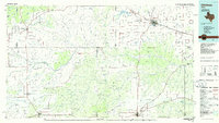
 1986 Vernon1986 Print · USGSNorth Texas and Southern Oklahoma meet along the river in the mid-1980s, revealing a landscape defined by ranching, oil production, and rail transport. Researchers can locate distinct landmarks such as Medicine Mound, the Conley Oil Field, and the community of Punkin Center.
 - 1986 Map of Wellington
 1986 Wellington1986 Print · USGSThe Texas Panhandle in the 1980s shows a landscape of cattle ranching and rail-dependent towns along the Burlington Northern. Trace family history and local industry through locations like the Citizens Cem, Greenbelt Reservoir, and Mc Knight.2 unique versions available
End of results
Showing maps 1-15 of 15
Top cities of Childress County
Frequently asked questions
- What are the different types of historical maps available for Childress County?
- What is the oldest map of Childress County?
- Where can I purchase historical maps of Childress County for my home or office?
- Where can I download high-res historical maps of Childress County?
- Are there historical topographic maps available for Childress County?
- Is there historical aerial imagery available for Childress County?
- Where are historical maps of Childress County sourced from?