Old Maps of Morton, Texas for Metal Detecting
Plan your next treasure hunt with 16 historic maps of Morton. Find old homesites, ghost towns, trails, and gathering spots that may be lost to time — perfect for identifying promising metal detecting locations.
- Locate forgotten sites: Uncover places like long-lost settlements, abandoned rail lines, or gathering spots.
- Plan better hunts: Use map overlays combined with LiDAR or satellite views to narrow in on historically rich areas.
- Made for detectorists: Thousands of hobbyists use these maps to discover relics, coins, and hidden history.
Use these historic maps to boost your research and find new opportunities beneath the surface of Morton.
Morton, TX maps
(16)- 1954 Map of Brownfield, 1975 Print
 1954 Brownfield1975 Print · USGSThe High Plains of the Texas-New Mexico border are captured here in the mid-twentieth century, as ranching and oil extraction shaped the Llano Estacado. Genealogists and historians can trace small rural centers like Lums Chapel, Hillburn City, and the Friendship Sch amid a landscape of windmills.2 unique versions available
 - 1958 Map of Brownfield
 1958 Brownfield1958 Print · USGSThe High Plains of the Texas-New Mexico border are captured here during a mid-century oil boom. Genealogists and historians can trace old community sites like Lums Chapel and Tokio alongside the vast Levelland and Slaughter Oil and Gas Field.
 - 1962 Map of Brownfield
 1962 Brownfield1962 Print · USGSThe High Plains of Texas and New Mexico are captured in the early sixties as a thriving hub of oil production and ranching. Researchers can trace the industrial footprint of the Levelland and Slaughter Oil and Gas Field or locate smaller towns like Sundown and Littlefield.
 - 1971 Map of Whiteface NW, 1973 Print
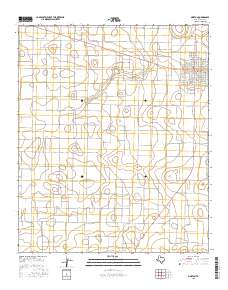
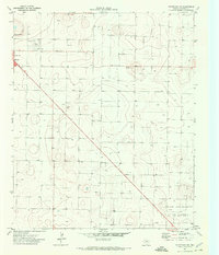 1971 Whiteface NW1973 Print · USGSCochran County is defined by the expansion of the energy sector and cattle culture in the early seventies. Genealogists and local historians can trace the footprint of Morton near the Rodeo Ground and the Levelland and Slaughter Oil and Gas Field.
 - 1971 Map of Morton, 1973 Print
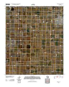
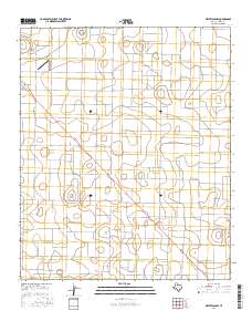
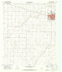 1971 Morton1973 Print · USGSCochran County agriculture and the town of Morton are captured here during the early seventies. Genealogists and local historians can trace the town street plan from Main St to the Cemetery and the outlying settlement of Famuliner.
 - 1985 Map of Levelland, 1986 Print
 1985 Levelland1986 Print · USGSThe West Texas High Plains are captured here in the mid-eighties as oil production and agriculture defined the region's economy. Researchers can trace the sprawling Levelland and Slaughter Oil and Gas Field or locate rural landmarks like Lums Chapel and South Plains College.2 unique versions available
 - 2010 Map of Whiteface NW, 2010 Print
 2010 Whiteface NW2010 Print · USGSCovers Morton, including Cochran County, United States, and other nearby areas
 - 2010 Map of Morton, 2010 Print
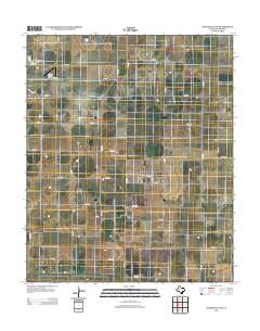
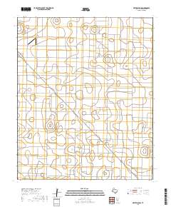
 2010 Morton2010 Print · USGSCovers Morton, including Famuliner, Star Route, and other nearby areas
 - 2012 Map of Morton, 2012 Print
 2012 Morton2012 Print · USGSCovers Morton, including Famuliner, Star Route, and other nearby areas
 - 2012 Map of Whiteface NW, 2012 Print
 2012 Whiteface NW2012 Print · USGSCovers Morton, including Cochran County, United States, and other nearby areas
 - 2016 Map of Morton, 2016 Print
 2016 Morton2016 Print · USGSCovers Morton, including Famuliner, Star Route, and other nearby areas
 - 2016 Map of Whiteface NW, 2016 Print
 2016 Whiteface NW2016 Print · USGSCovers Morton, including Cochran County, United States, and other nearby areas
 - 2019 Map of Morton, 2019 Print
 2019 Morton2019 Print · USGSCovers Morton, including Famuliner, Star Route, and other nearby areas
 - 2019 Map of Whiteface NW, 2019 Print
 2019 Whiteface NW2019 Print · USGSCovers Morton, including Cochran County, United States, and other nearby areas
 - 2022 Map of Morton, 2022 Print
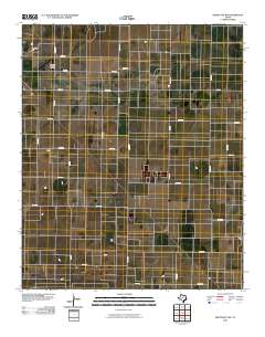
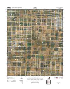
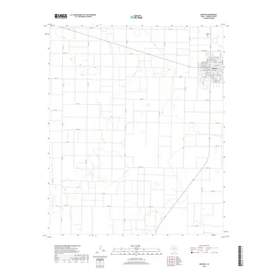
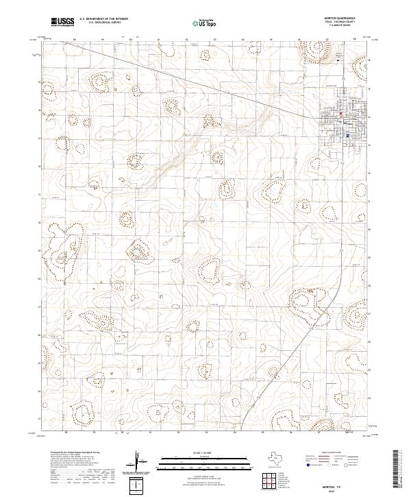 2022 Morton2022 Print · USGSSettled on the High Plains of the Texas Panhandle, Morton appears here in a clear grid of residential streets and rural section roads. Researchers can locate the Cochran County Courthouse or find family plots at the Morton Memorial Cem.
 - 2022 Map of Whiteface NW, 2022 Print
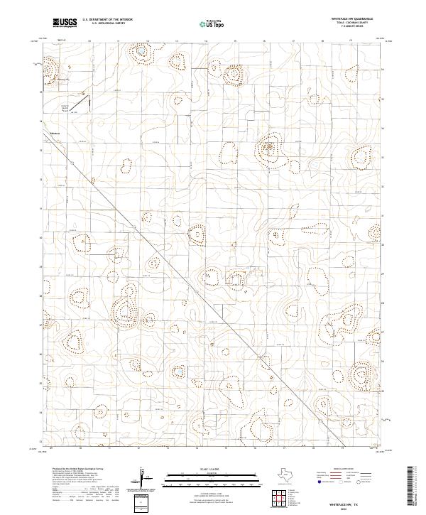 2022 Whiteface NW2022 Print · USGSThe Llano Estacado of West Texas is revealed through a precision grid of agricultural roads and regional flight infrastructure in the early 2020s. Trace the rural development around Morton and the Cochran County Airport to see how this high plains landscape is organized.
End of results
Showing maps 1-16 of 16
Top cities near Morton
Frequently asked questions
- What are the different types of historical maps available for Morton?
- What is the oldest map of Morton?
- Where can I purchase historical maps of Morton for my home or office?
- Where can I download high-res historical maps of Morton?
- Are there historical topographic maps available for Morton?
- Is there historical aerial imagery available for Morton?
- Where are historical maps of Morton sourced from?