
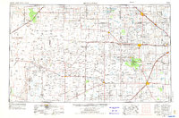
1954 Map of Brownfield
USGS Topo · Published 1975About this map
Mescalero Sands and the high desert plateaus of the Llano Estacado define this mid-1970s look at the Texas-New Mexico borderlands. The landscape is a study in early water management and extraction, characterized by a dense network of windmills scattered across ranch lands and wide ephemeral drainage patterns like Sulphur Springs Draw, Yellow House Draw, and Lost Draw. Significant geological markers like Railroad Mountain and Button Mesa rise above the surrounding terrain, while the northern section is anchored by the Muleshoe NWR and its associated salt lakes.
Find a feature on this map
91 named features on this map. Tap any name to fly to it.
Don’t see what you’re looking for? This feature index may not catch every label — zoom into the map to look around manually.
Map Details
Editions of this 1954 Brownfield Map
2 editions found
Other maps of this area

1949 · Sardine Mountain
USGS Topo · 1:24,000

1949 · Malstrom Ranch
USGS Topo · 1:24,000

1951 · King Camp
USGS Topo · 1:24,000

1952 · Connor Well
USGS Topo · 1:24,000

1953 · Basin Well
USGS Topo · 1:24,000

1954 · Lubbock
USGS Topo · 1:250,000

1954 · Carlsbad
USGS Topo · 1:250,000

1954 · Hobbs
USGS Topo · 1:250,000

1954 · Fort Sumner
USGS Topo · 1:250,000

1954 · Big Spring
USGS Topo · 1:250,000