1951 Map of King Camp
USGS Topo · Published 1953About this map
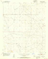
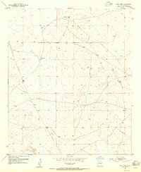
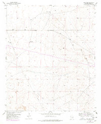
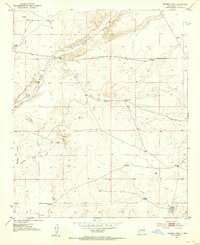
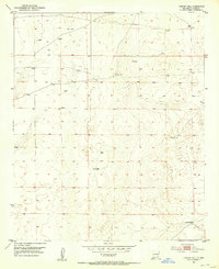
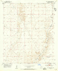
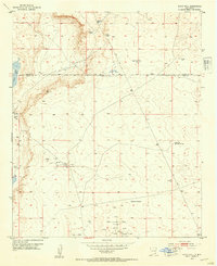
King Camp and the Anchor D Ranch anchor this mid-century survey of the arid Chaves County terrain. This landscape is defined by the practical infrastructure of the cattle and energy industries, as evidenced by the Pipe Line cutting through the southern sections and several isolated Windmill locations used for water management. The map details the Township and Range boundaries, specifically T. 14 S. and T. 15 S. and R. 28 E. and R. 29 E., which organized the land for ranching and mineral exploration during this post-war era. The sparse distribution of named settlements reflects the vast scale of agricultural operations in this part of New Mexico, where life revolved around these established ranching hubs and their vital water sources.
Find a feature on this map
6 named features on this map. Tap any name to fly to it.
Don’t see what you’re looking for? This feature index may not catch every label — zoom into the map to look around manually.
Map Details
Editions of this 1951 King Camp Map
Other maps of this area
1951 · Ninemile Well
USGS Topo · 1:24,000

1951 · Diamond Mound
USGS Topo · 1:24,000
1952 · Connor Well
USGS Topo · 1:24,000
1952 · Bar C Bar Ranch
USGS Topo · 1:24,000
1953 · Basin Well
USGS Topo · 1:24,000

1954 · Carlsbad
USGS Topo · 1:250,000

1954 · Hobbs
USGS Topo · 1:250,000

1954 · Brownfield
USGS Topo · 1:250,000

1955 · Roswell
USGS Topo · 1:250,000

1958 · Carlsbad
USGS Topo · 1:250,000