
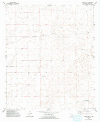
1952 Map of Connor Well
USGS Topo · Published 1953About this map
Malmstrom and Connor Well anchor this section of Chaves County, where the high plains landscape is defined by the vital infrastructure of ranching and early petroleum exploration. This 1952 topographic study, compiled from aerial photography taken in 1947, reveals a terrain sparsely dotted with essential water sources like Windmill 3655 and several unnamed Tank features. The map illustrates the precarious nature of early industry in the desert, marking several sites as Oil Well (Aban'd) and Windmill (Aban'd). Near the southern boundary, Horse Camp Wells sits at the base of the rising ground, providing a localized center for activity in an otherwise open range. The layout of these wells and windmills highlights the distribution of resources required to sustain life and commerce in this arid environment before modern expansion.
Find a feature on this map
14 named features on this map. Tap any name to fly to it.
Don’t see what you’re looking for? This feature index may not catch every label — zoom into the map to look around manually.
Map Details
Editions of this 1952 Connor Well Map
2 editions found
Other maps of this area

1949 · Wade Ranch
USGS Topo · 1:24,000

1949 · Malstrom Ranch
USGS Topo · 1:24,000

1951 · Ninemile Well
USGS Topo · 1:24,000

1951 · King Camp
USGS Topo · 1:24,000

1952 · Bar C Bar Ranch
USGS Topo · 1:24,000

1954 · Brownfield
USGS Topo · 1:250,000

1955 · Roswell
USGS Topo · 1:250,000

1958 · Brownfield
USGS Topo · 1:250,000

1958 · Roswell
USGS Topo · 1:250,000

1962 · Roswell
USGS Topo · 1:250,000