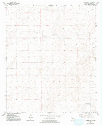
1952 Map of Connor Well
USGS Topo · Published 1992About this map
The arid high plains of Chaves County are defined by their scattered water sources and early petroleum exploration in this mid-century survey. Connor Well serves as a central landmark in a landscape where survival and industry both depend on subsurface resources. The terrain near Malmstrom is dotted with numerous small Tanks, reflecting the essential water management required for ranching in the New Mexico desert. The presence of multiple locations marked (Aban'd), including several Oil Wells, suggests a period of transition as early drilling efforts moved across the quadrangle. In the southeastern corner, the Horse Camp Wells represent another vital water point for local operations. This map documents a specific phase of land use where the search for oil and the maintenance of livestock intersected across a network of unimproved roads and survey lines.
Find a feature on this map
8 named features on this map. Tap any name to fly to it.
Don’t see what you’re looking for? This feature index may not catch every label — zoom into the map to look around manually.
Map Details
Editions of this 1952 Connor Well Map
2 editions found
Other maps of this area

1949 · Wade Ranch
USGS Topo · 1:24,000

1949 · Malstrom Ranch
USGS Topo · 1:24,000

1951 · Ninemile Well
USGS Topo · 1:24,000

1951 · King Camp
USGS Topo · 1:24,000

1952 · Connor Well
USGS Topo · 1:24,000

1952 · Bar C Bar Ranch
USGS Topo · 1:24,000

1954 · Brownfield
USGS Topo · 1:250,000

1955 · Roswell
USGS Topo · 1:250,000

1958 · Brownfield
USGS Topo · 1:250,000

1958 · Roswell
USGS Topo · 1:250,000