
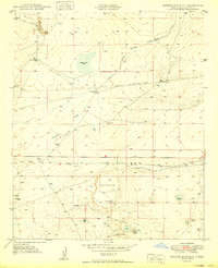
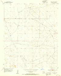
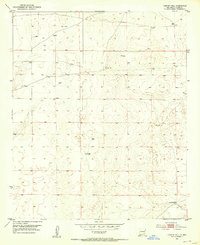
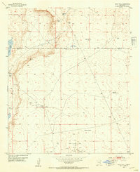
1958 Map of Brownfield
USGS Topo · Published 1958About this map
Levelland and Slaughter Oil and Gas Field dominates the central Texas landscape in this mid-century survey of the South Plains and Llano Estacado. The map reveals an intensive petroleum and agricultural economy defined by a dense grid of windmills and extensive oil development, including the Bledsoe Oil and Gas Field and Gladiola Oil and Gas Field. To the west, the terrain shifts dramatically at the New Mexico State Line as the landscape drops toward the Mescalero Ridge and the drifting Mescalero Sands.
Find a feature on this map
108 named features on this map. Tap any name to fly to it.
Don’t see what you’re looking for? This feature index may not catch every label — zoom into the map to look around manually.
Map Details
Editions of this 1958 Brownfield Map
This is the sole edition of this map. No revisions or reprints were ever made.
Other maps of this area
1949 · Sardine Mountain
USGS Topo · 1:24,000

1949 · Malstrom Ranch
USGS Topo · 1:24,000
1951 · King Camp
USGS Topo · 1:24,000
1952 · Connor Well
USGS Topo · 1:24,000
1953 · Basin Well
USGS Topo · 1:24,000

1954 · Lubbock
USGS Topo · 1:250,000

1954 · Carlsbad
USGS Topo · 1:250,000

1954 · Hobbs
USGS Topo · 1:250,000

1954 · Fort Sumner
USGS Topo · 1:250,000

1954 · Big Spring
USGS Topo · 1:250,000