Old Maps of Coryell County, Texas
Explore 223 old maps of Coryell County, spanning from 1887 to today. These high-resolution historic maps reveal how streets, neighborhoods, landmarks, and natural features evolved over time — perfect for genealogy, metal detecting, research, and local history exploration.
What you can do with these maps:
- See how Coryell County changed over time: Compare historical maps to modern-day views to trace roads, homesites, rail lines & more.
- View detailed metadata: Each map includes creators, publishers, year, scale, and archive source.
- Overlay maps with satellite & LiDAR: Visualize the past alongside modern tools to explore terrain & human change.
- Trusted historical sources: Maps sourced from the USGS, Library of Congress, and other archives.
- Access maps your way: View online, download high-res files, or order prints for personal or research use.
Start exploring old maps of Coryell County to uncover forgotten places, hidden landmarks, and the deep history beneath your feet.
Coryell County, TX maps
(223)- 1887 Map of Lampasas
 1887 Lampasas1887 Print · USGSThe Lampasas region in the late 1880s shows the arrival of the Gulf Colorado and Santa Fe Railroad alongside early frontier settlements. Local historians can trace old post offices and milling sites like Townsen Mills, Wayback, and Senterfitt among the numerous gaps and peaks of the Hill Country.
 - 1888 Map of Hamilton
 1888 Hamilton1888 Print · USGSCentral Texas during the 1880s is captured here at a moment of early frontier growth and agricultural settlement. Researchers can trace the original locations of rural centers like Gentry Mill, Pottsville, and the remote post office at Indian Gap.
 - 1888 Map of Meridian
 1888 Meridian1888 Print · USGSBosque and Coryell counties are shown here in the 1880s as the rail lines began to redefine the frontier landscape. Genealogists can locate early settlements like Turnersville, Cranfills Gap, and the rail junction at Meridian.
 - 1892 Map of Temple
 1892 Temple1892 Print · USGSTexas at the turn of the century shows a landscape defined by emerging railroad junctions and river settlements. Genealogists can trace early homesteads and rail-town growth in Temple, McGregor, and Belton near the banks of the Leon River.6 unique versions available
 - 1894 Map of Hamilton
 1894 Hamilton1894 Print · USGSCentral Texas ranching and farming communities are captured here in the 1890s, just after the initial frontier period. Genealogists can locate family-named landmarks and early settlements like Gentry Mill, Indian Gap, and Hazle Dell along the Leon River.5 unique versions available
 - 1894 Map of Meridian
 1894 Meridian1894 Print · USGSBosque and Coryell counties are shown in the late nineteenth century as the railroads began to reshape the cattle frontier. Genealogists and local historians can trace early settlements and community landmarks like Norse, Cranfills Gap, and Turnersville.3 unique versions available
 - 1894 Map of Lampasas
 1894 Lampasas1894 Print · USGSLampasas and the surrounding hill country are shown in the years following the arrival of the rail. Genealogists can trace family-named landmarks like Kinchelo Peak and old post offices at Senterfitt, Nix, and Wayback.4 unique versions available
 - 1894 Map of Gatesville
 1894 Gatesville1894 Print · USGSCentral Texas in the late nineteenth century was a landscape of expanding rail lines and established river settlements. Genealogists can trace family names across Pidcock Ranch, Fort Gates, and Coperas Cove, while following the path of the St. Louis Arkansas and Texas Railroad.4 unique versions available
 - 1924 Map of Gatesville 4-a
 1924 Gatesville 4-a1924 Print · USGSBell and Coryell Counties are mapped here in the mid-1920s, revealing a landscape of upland farms and valley crossings. Genealogists can trace early landmarks like Seattle, Sparta, and Liberty Hill Church, along with rural schoolhouses such as Phoenix School.
 - 1924 Map of Temple 2-C
 1924 Temple 2-C1924 Print · USGSCentral Texas farming communities and river crossings are captured here in the mid-1920s across the Bell, Coryell, and McLennan county lines. Genealogists can trace family footprints at Haunted Hill School, Whitson, and the German Lutheran Church.
 - 1930 Map of Killeen
 1930 Killeen1930 Print · USGSBell County was a landscape of small school districts and river crossings in the early thirties. Genealogists can trace family roots through rural landmarks like Keyes Valley Sch, Youngsport, and the Santa Fe line at Stone Siding.2 unique versions available
 - 1931 Map of Mc Gregor
 1931 Mc Gregor1931 Print · USGSCentral Texas rural life in the twenties is preserved here, showing a landscape densely dotted with family-named schools and country churches. Genealogists can trace ancestors through specific landmarks like Haunted Hill Sch, Blair Chapel, and the community at Eagle Springs.2 unique versions available
 - 1947 Map of Fort Hood
 1947 Fort Hood1947 Print · USGSCoryell and Lampasas Counties are shown here during the post-war expansion of military and rail infrastructure. Researchers can trace the layout of Fort Hood alongside rural landmarks like Willow Springs School, Starkle Cemetery, and the Variety Club Boys Ranch.
 - 1947 Map of Bland, 1953 Print
 1947 Bland1953 Print · USGSBell and Coryell County rural life is captured here in the late 1940s, documenting a landscape of small schools and family cemeteries. Trace the heritage of Sparta and Bland or locate ancestral sites like Liberty Hill Cem and Phoenix Sch.
 - 1947 Map of Fort Hood, 1953 Print
 1947 Fort Hood1953 Print · USGSFort Hood and its surrounding Texas hill country are captured here just after the war, showing the post's massive expansion across the county line. Researchers can trace the original cantonment layout near the Station Hospital or locate early training sites like the IMPACT AREA and Jack Mountain Ranges.
 - 1947 Map of Purmela, 1953 Print
 1947 Purmela1953 Print · USGSCentral Texas rural life and military expansion meet in the late 1940s as settlements like Purmela and Pidcoke border federal lands. Genealogists can trace family roots through Slater Cem, Harman Sch, and the Spring Hill Cem.
 - 1947 Map of Post Oak Mountain, 1953 Print
 1947 Post Oak Mountain1953 Print · USGSKilleen and the surrounding hill country are shown just after the war, as the military presence at Fort Hood transformed the local landscape. Genealogists and historians can trace early residential areas like Jan Mock Village or find old river crossings such as Mason Crossing and Riggs Ford.
 - 1947 Map of Killeen, 1953 Print
 1947 Killeen1953 Print · USGSBell and Coryell Counties appear here in the years following the war, showcasing the early growth of Killeen and the Fort Hood Military Reservation. Local historians can trace vanished schoolhouses and churches like Union Hill Sch and McDowell Ch alongside the Gulf Colorado and Santa Fe line.
 - 1947 Map of McMillan Mountains, 1953 Print
 1947 McMillan Mountains1953 Print · USGSCentral Texas hills and military expansion meet in the late 1940s near the Bell and Coryell county line. Researchers can trace family landmarks like Mayberry Cem and the Willow Springs Sch against the rising presence of the Fort Hood Military Reservation.
 - 1947 Map of Oglesby, 1953 Print
 1947 Oglesby1953 Print · USGSOglesby and the surrounding Coryell County countryside are documented here in the years following the war. Researchers can trace the St Louis Southwestern rail line and locate community landmarks like Pecan Grove Ch and Post Oak Cem.
 - 1947 Map of Gatesville West, 1953 Print
 1947 Gatesville West1953 Print · USGSThe rural outskirts of Coryell County are captured here in the late 1940s as military expansion met traditional ranching life. Genealogists can trace early landmarks like Hemelline Cem, Standlee Chapel, and the Plainview Sch near the Leon River.
 - 1947 Map of Pidcoke, 1953 Print
 1947 Pidcoke1953 Print · USGSCoryell County settlement meets military expansion in the late 1940s as rural communities adjusted to the neighboring Army installation. Genealogists can trace family landmarks like Harman Sch, the Pidcoke Cem, and old routes through Slater.
 - 1947 Map of Leon Junction, 1953 Print
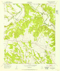 1947 Leon Junction1953 Print · USGSCoryell County is captured here in the late 1940s as rural life centered around the St Louis Southwestern railroad and the Leon River. Local historians can trace family roots at The Grove, Leon Junction, and the King Cem.
 - 1947 Map of North Fort Hood, 1953 Print
 1947 North Fort Hood1953 Print · USGSCoryell County in the late 1940s shows the expanding footprint of the Fort Hood Military Reservation over the Texas landscape. Genealogists can locate family burial grounds like Bethel Cem and Ruth Cem or the site of Hubbard Sch among the hills and firing ranges.
 - 1947 Map of Purmela, 1953 Print
 1947 Purmela1953 Print · USGSCoryell County ranching country is documented here shortly after the war, showing the network of small settlements and family landmarks. Genealogists can locate family names at Smith Cem, Purmela Sch, and the community of Arnett.
Showing maps 1-25 of 223
Top cities of Coryell County
- Copperas Cove historical maps
- Gatesville historical maps
- Oglesby historical maps
- South Mountain historical maps
Frequently asked questions
- What are the different types of historical maps available for Coryell County?
- What is the oldest map of Coryell County?
- Where can I purchase historical maps of Coryell County for my home or office?
- Where can I download high-res historical maps of Coryell County?
- Are there historical topographic maps available for Coryell County?
- Is there historical aerial imagery available for Coryell County?
- Where are historical maps of Coryell County sourced from?