1900s (20th Century) Maps of Four Corner Windmill, Texas
Explore 5 historic maps of Four Corner Windmill from the 1900s (20th Century). These maps offer a rare glimpse into what life looked like during the 1900s — showing old roads, neighborhoods, homes, and landmarks that have changed or disappeared over time.
Whether you're researching your family's past, planning a metal detecting trip, or studying how Four Corner Windmill's landscape evolved across the 1900s, these high-resolution maps are a powerful tool for exploring the history of this region.
- Focus on a specific era: All maps on this page are from the 1900s, giving you a focused view of this time period.
- See what’s changed: Compare century-old streets, trails, and buildings to today's modern landscape using overlays and satellite layers.
- Research with precision: Use these maps for genealogy, historical research, land use analysis, or educational projects.
- View, download, or print: Maps are fully viewable online in high resolution, and can be downloaded or printed for your own records.
Start exploring Four Corner Windmill's history through authentic maps from the 1900s. This is your window into the past.
Four Corner Windmill, TX maps
(5)- 1929 Map of Sheffield
 1929 Sheffield1929 Print · USGSWest Texas ranching and the early oil boom meet along the Pecos River in the late twenties. Researchers can trace the Old Spanish Trail through Sheffield or locate historical sites like Fort Lancaster and the Yates Oil Field.
 - 1954 Map of Sonora, 1965 Print
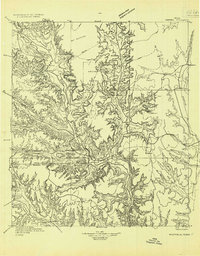
 1954 Sonora1965 Print · USGSThe Edwards Plateau and West Texas ranching country come alive in this mid-century survey of the canyons and plateaus. Genealogists and historians can trace the remote settlements of Pandale and Loma Alta or follow the path of the Panhandle and Santa Fe RR.2 unique versions available
 - 1958 Map of Sonora
 1958 Sonora1958 Print · USGSThe Edwards Plateau and Trans-Pecos region come alive in the late fifties, showing a landscape of remote ranchlands and historic frontier outposts. Trace the legacy of Fort Lancaster Ruins, the limestone depths of Devils Sinkhole Cavern, and the path of the Pecos River.
 - 1967 Map of Bachelor Hill, 1970 Print
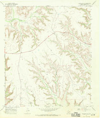 1967 Bachelor Hill1970 Print · USGSCrockett County ranch land and resource extraction are documented in the late sixties before modern development. Genealogists and researchers can trace family sites at Graves or locate regional landmarks like Escondido Water Hole and the Four Corner Windmill.
 - 1985 Map of Ozona
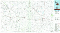 1985 Ozona1985 Print · USGSCrockett County in the mid-eighties was a land of sprawling oil fields and high desert plateaus. Genealogists and local historians can trace the foundations of Fort Lancaster (Ruins) and follow the vital watercourse of the Pecos River near Sheffield.2 unique versions available
End of results
Showing maps 1-5 of 5
Frequently asked questions
- What are the different types of historical maps available for Four Corner Windmill?
- What is the oldest map of Four Corner Windmill?
- Where can I purchase historical maps of Four Corner Windmill for my home or office?
- Where can I download high-res historical maps of Four Corner Windmill?
- Are there historical topographic maps available for Four Corner Windmill?
- Is there historical aerial imagery available for Four Corner Windmill?
- Where are historical maps of Four Corner Windmill sourced from?