2020s Maps of Crosbyton, Texas
Explore 3 historic maps of Crosbyton from the 2020s. These maps offer a rare glimpse into what life looked like during the 2020s — showing old roads, neighborhoods, homes, and landmarks that have changed or disappeared over time.
Whether you're researching your family's past, planning a metal detecting trip, or studying how Crosbyton's landscape evolved across the 2020s, these high-resolution maps are a powerful tool for exploring the history of this region.
- Focus on a specific era: All maps on this page are from the 2020s, giving you a focused view of this time period.
- See what’s changed: Compare century-old streets, trails, and buildings to today's modern landscape using overlays and satellite layers.
- Research with precision: Use these maps for genealogy, historical research, land use analysis, or educational projects.
- View, download, or print: Maps are fully viewable online in high resolution, and can be downloaded or printed for your own records.
Start exploring Crosbyton's history through authentic maps from the 2020s. This is your window into the past.
Crosbyton, TX maps
(3)- 2022 Map of Ralls NE, 2022 Print
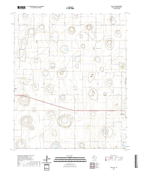 2022 Ralls NE2022 Print · USGSCrosby County agricultural lands and the fringes of two historic plains towns are captured in the early 2020s. Genealogists and land researchers can trace property boundaries and rural routes like Co Rd 162 between Ralls and Crosbyton.
 - 2022 Map of Collett Springs, 2022 Print
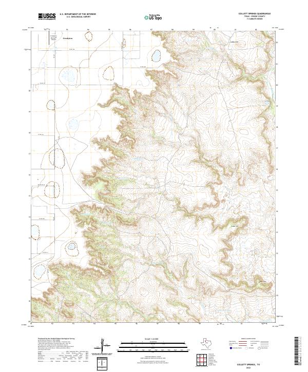 2022 Collett Springs2022 Print · USGSCrosby County is captured here where the high plains break into deep canyons and ranch land. Researchers can trace the drainage of White River and Blue Hole Cr or locate specific landmarks like Indian Hill and the Crosbyton Municipal Airport.
 - 2022 Map of Crosbyton, 2022 Print
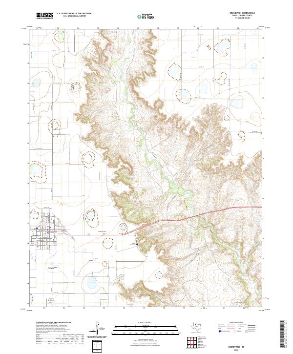 2022 Crosbyton2022 Print · USGSCrosbyton and the surrounding Caprock country are documented here as the high plains drop into the breaks of Blanco Canyon. Genealogists and local historians can trace family roots at the Crosby County Courthouse, Crosbyton Cem, and the secluded Mount Zion Cem.
End of results
Showing maps 1-3 of 3
Top cities near Crosbyton
Frequently asked questions
- What are the different types of historical maps available for Crosbyton?
- What is the oldest map of Crosbyton?
- Where can I purchase historical maps of Crosbyton for my home or office?
- Where can I download high-res historical maps of Crosbyton?
- Are there historical topographic maps available for Crosbyton?
- Is there historical aerial imagery available for Crosbyton?
- Where are historical maps of Crosbyton sourced from?