1900s (20th Century) Maps of Ralls, Texas
Explore 4 historic maps of Ralls from the 1900s (20th Century). These maps offer a rare glimpse into what life looked like during the 1900s — showing old roads, neighborhoods, homes, and landmarks that have changed or disappeared over time.
Whether you're researching your family's past, planning a metal detecting trip, or studying how Ralls's landscape evolved across the 1900s, these high-resolution maps are a powerful tool for exploring the history of this region.
- Focus on a specific era: All maps on this page are from the 1900s, giving you a focused view of this time period.
- See what’s changed: Compare century-old streets, trails, and buildings to today's modern landscape using overlays and satellite layers.
- Research with precision: Use these maps for genealogy, historical research, land use analysis, or educational projects.
- View, download, or print: Maps are fully viewable online in high resolution, and can be downloaded or printed for your own records.
Start exploring Ralls's history through authentic maps from the 1900s. This is your window into the past.
Ralls, TX maps
(4)- 1954 Map of Lubbock, 1958 Print
 1954 Lubbock1958 Print · USGSThe High Plains and Caprock region of West Texas come alive in the mid-1950s, showing a landscape defined by oil discovery and the Brazos River headwaters. Genealogists and historians can trace rail-connected towns like Roaring Springs, find the Pleasant Valley church, or locate family-named landmarks such as Soldier Mound.4 unique versions available
 - 1967 Map of Ralls NE, 1968 Print
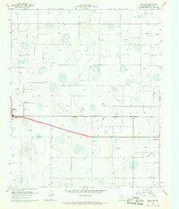 1967 Ralls NE1968 Print · USGSCrosby County in the late sixties reveals a landscape of intensive irrigation and rail-connected settlements. Genealogists and researchers can locate Fairview Sch, trace the Atchison Topeka and Santa Fe line, or explore the fringes of Ralls and Crosbyton.2 unique versions available
 - 1967 Map of Ralls, 1968 Print
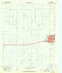 1967 Ralls1968 Print · USGSThe High Plains of West Texas are captured here in the late sixties, centered on the railroad town of Ralls. Genealogists and historians can trace the town’s development via the High Sch, the local Cemetery, and the Atchison Topeka and Santa Fe rail line.
 - 1986 Map of Lubbock
 1986 Lubbock1986 Print · USGSLubbock and the surrounding High Plains are documented in the mid-eighties as a structured grid of agricultural tracts and growing urban centers. Genealogists and local historians can trace family-named areas like Heckville, old rail stops on the Atchison Topeka and Santa Fe, and the winding path of Yellow House Canyon.2 unique versions available
End of results
Showing maps 1-4 of 4
Top cities near Ralls
Frequently asked questions
- What are the different types of historical maps available for Ralls?
- What is the oldest map of Ralls?
- Where can I purchase historical maps of Ralls for my home or office?
- Where can I download high-res historical maps of Ralls?
- Are there historical topographic maps available for Ralls?
- Is there historical aerial imagery available for Ralls?
- Where are historical maps of Ralls sourced from?