Old Maps of Edwards County, Texas for Academic Research
Study the evolution of Edwards County with 320 high-resolution historic maps. Whether you're teaching, researching, or modeling changes in land use, these maps provide essential visual documentation of urban, environmental, and geographic change.
- Analyze long-term change: Track patterns in development, transportation, and natural features.
- Ideal for environmental or urban studies: Support academic projects with primary historical map data.
- Use in the classroom or lab: Educators and researchers rely on these maps to bring historical context to life.
These maps are a powerful tool for teaching, research, and visualizing how Edwards County has changed over the decades.
Edwards County, TX maps
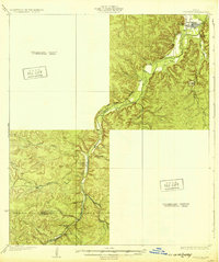
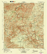
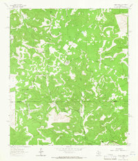
(320)- 1893 Map of Rock Springs
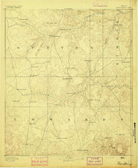 1893 Rock Springs1893 Print · USGSThe Edwards Plateau in the early 1890s was a remote ranching frontier defined by isolated outposts and limestone river breaks. Researchers can locate early family holdings such as Marsh & Taylor's Ranch and landmarks like the Devils Sink Hole.5 unique versions available
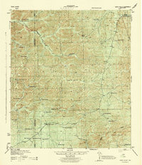
 - 1893 Map of Nueces
 1893 Nueces1893 Print · USGSTexas ranching culture and the canyons of the Nueces River are captured here during the 1890s frontier era. Genealogists and local historians can trace early family landholdings like the Ford and Holliday Ranch and remote settlements such as Camp Wood or Barksdale.
 - 1896 Map of Nueces
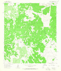
 1896 Nueces1896 Print · USGSThe upper Nueces River valley in the 1890s is captured here as a network of isolated family ranches and riverfront settlements. Genealogists and historians can trace early landholders at the Ford and Holliday Ranch, Johnson Ranch, and Hillcoat Ranch.4 unique versions available
 - 1926 Map of Segovia 2-c
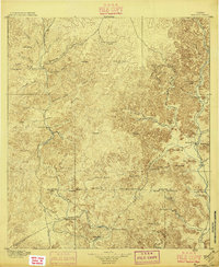
 1926 Segovia 2-c1926 Print · USGSKimble and Edwards Counties appear here during the mid-twenties as the South Llano River was being meticulously surveyed for water resources. Researchers can pinpoint the remote Telegraph settlement, Evergreen School, and the hydrologically significant Seven Hundred Springs.
 - 1932 Map of Junction
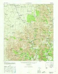
 1932 Junction1932 Print · USGSJunction and the surrounding Hill Country are captured in the early thirties as the local road network began to formalize. Genealogists and researchers can trace the locations of Evergreen Sch, Paint Rock Sch, and the riverside settlement of Telegraph.2 unique versions available
 - 1943 Map of Carta Valley
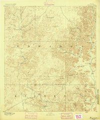
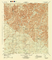
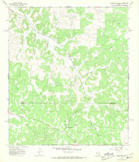
 1943 Carta Valley1943 Print · USGSTexas ranching culture is preserved in this wartime survey of the Edwards Plateau. Researchers can trace historic family holdings across the landscape, from Carta Valley to remote outposts like Wittenburg Ranch, Camp Brown Ranch, and Galloway Ranch.
 - 1944 Map of Barksdale
 1944 Barksdale1944 Print · USGSThe Edwards County ranching country of the mid-1940s is detailed here during the expansion of rural utility lines and cattle operations. Genealogists can locate family-named landmarks like Double Wells Ranch, Old Chapman Place, and the riverfront grounds of Camp Wood.
 - 1944 Map of Flat Rock
 1944 Flat Rock1944 Print · USGSRanching life on the Edwards Plateau is captured during the mid-1940s, showing a landscape defined by seasonal creek forks and family-owned lands. Researchers can trace historic property boundaries and water sources like the Thurman Well, Askew Ranch, and Hayes Ranch.
 - 1944 Map of Indian Creek
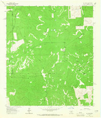
 1944 Indian Creek1944 Print · USGSEdwards County ranching culture is preserved here during the mid-1940s, showing a landscape defined by water and wide-open range. Researchers can trace historic family boundaries and water sources like the Shreiner Ranch, Kickapoo Spring, and the Nueces River.
 - 1944 Map of Indian Mountain
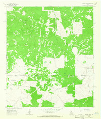
 1944 Indian Mountain1944 Print · USGSThe ranchlands of the Edwards Plateau are frozen in time during the 1940s, where the Nueces River winds through high hills and deep draws. Genealogists and historians can trace legacy family holdings like Covington Ranch, Seargeant Ranch, and McNealy Ranch across the county lines.
 - 1947 Map of Hackberry, 1973 Print
 1947 Hackberry1973 Print · USGSRanching life in the Edwards Plateau is captured here just after the war. Family historians can trace ancestral holdings like Wittenburg Ranch and Hampton Ranch, or locate the rural Cedar Creek School.
 - 1954 Map of Llano, 1964 Print
 1954 Llano1964 Print · USGSThe Texas Hill Country and Highland Lakes appear in the mid-fifties, just as new reservoirs began reshaping the landscape. Trace ranching history and river routes from Mason to Llano, or follow the Gulf Colorado and Santa Fe RR past Buchanan Lake.2 unique versions available
 - 1954 Map of San Antonio, 1964 Print
 1954 San Antonio1964 Print · USGSSan Antonio and the Texas Hill Country are captured here in the mid-fifties, showing a landscape defined by massive military air bases and the rising Canyon Reservoir. Trace family ties through historic rail towns like D'Hanis and Castroville or explore the Cold War footprint of Lackland AFB and Randolph AFB.3 unique versions available
 - 1954 Map of Sonora, 1965 Print
 1954 Sonora1965 Print · USGSThe Edwards Plateau and West Texas ranching country come alive in this mid-century survey of the canyons and plateaus. Genealogists and historians can trace the remote settlements of Pandale and Loma Alta or follow the path of the Panhandle and Santa Fe RR.2 unique versions available
 - 1955 Map of Llano
 1955 Llano1955 Print · USGSCentral Texas and the Hill Country are seen here during the mid-1950s growth of the Highland Lakes. Trace old settlements and geologic landmarks from Enchanted Rock and Longhorn Cavern to the small community of Luckenbach.
 - 1956 Map of Llano, 1976 Print
 1956 Llano1976 Print · USGSThe Texas Hill Country comes alive in this mid-seventies survey of the Llano Uplift and Colorado River lakes. Genealogists and historians can trace family roots through settlements like Luckenbach and Castell or locate the famed L B J Ranch and Enchanted Rock.
 - 1957 Map of San Antonio
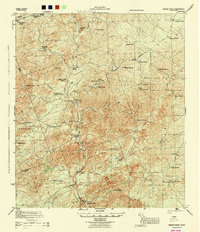
 1957 San Antonio1957 Print · USGSSan Antonio and the Texas Hill Country are shown here during the mid-fifties, capturing the region's expanding post-war military and transportation footprint. Genealogists and local historians can trace the early residential boundaries of Alamo Heights or locate rural landmarks like St Hedwig and Medina Lake.
 - 1958 Map of Sonora
 1958 Sonora1958 Print · USGSThe Edwards Plateau and Trans-Pecos region come alive in the late fifties, showing a landscape of remote ranchlands and historic frontier outposts. Trace the legacy of Fort Lancaster Ruins, the limestone depths of Devils Sinkhole Cavern, and the path of the Pecos River.
 - 1958 Map of Del Rio, 1970 Print
 1958 Del Rio1970 Print · USGSThe Texas-Mexico borderlands come alive in the late fifties, showing the confluence of the Rio Grande and the emerging Amistad Reservoir. Trace the lineage of the Southern Pacific rail line through stops at Pumpville, Shumla, and the mining vicinity of Blewett.2 unique versions available
 - 1962 Map of Hill Ranch, 1965 Print
 1962 Hill Ranch1965 Print · USGSTexas ranching culture is well-documented in this early 1960s survey of the Kimble and Edwards County lines. Genealogists can locate specific family lands like Cardwell Ranch, Nethery Ranch, and Jetton Ranch along the waters of Knust Draw.2 unique versions available
 - 1962 Map of Stewart Ranch, 1966 Print
 1962 Stewart Ranch1966 Print · USGSThe West Texas ranchlands along the Sutton and Edwards county line are documented here in the early 1960s. Genealogists and historians can trace family landholdings like Stewart Ranch and Miers Ranch or locate the path of Bond Road.2 unique versions available
 - 1962 Map of Bundy Ranch, 1966 Print
 1962 Bundy Ranch1966 Print · USGSRanching outposts and river valleys define this West Texas landscape in the early sixties. Researchers can trace family-named lands like Sawyer Ranch and Mayfield Ranch or locate the remote Landing Strip and Eagle Well.2 unique versions available
 - 1963 Map of Harrison Ranch, 1965 Print
 1963 Harrison Ranch1965 Print · USGSRanching and early energy development meet in the 1960s along the Sutton and Edwards county line. Local historians can trace the operations of Harrison Ranch and Brockman Ranch or locate the Miers Wilson Gas Field and its early wells.2 unique versions available
 - 1964 Map of Del Rio
 1964 Del Rio1964 Print · USGSAlong the Mexican border during the mid-sixties, this area centered on the confluence of the Rio Grande and Devils River. Researchers can trace the Southern Pacific line through isolated stops like Pumpville or locate military and industrial sites such as Laughlin Air Force Base and the mines at Blewett.
 - 1967 Map of Dunbar Draw SW, 1969 Print
 1967 Dunbar Draw SW1969 Print · USGSSutton and Edwards Counties are shown here in the late sixties as a landscape of working ranches and oil production. Genealogists and researchers can locate family properties like Rex Cusenbary Ranch and the Texas A and M Experimental Station.3 unique versions available
Showing maps 1-25 of 320
Top cities of Edwards County
Frequently asked questions
- What are the different types of historical maps available for Edwards County?
- What is the oldest map of Edwards County?
- Where can I purchase historical maps of Edwards County for my home or office?
- Where can I download high-res historical maps of Edwards County?
- Are there historical topographic maps available for Edwards County?
- Is there historical aerial imagery available for Edwards County?
- Where are historical maps of Edwards County sourced from?