1960s Maps of Edwards County, Texas
Explore 8 historic maps of Edwards County from the 1960s. These maps offer a rare glimpse into what life looked like during the 1960s — showing old roads, neighborhoods, homes, and landmarks that have changed or disappeared over time.
Whether you're researching your family's past, planning a metal detecting trip, or studying how Edwards County's landscape evolved across the 1960s, these high-resolution maps are a powerful tool for exploring the history of this region.
- Focus on a specific era: All maps on this page are from the 1960s, giving you a focused view of this time period.
- See what’s changed: Compare century-old streets, trails, and buildings to today's modern landscape using overlays and satellite layers.
- Research with precision: Use these maps for genealogy, historical research, land use analysis, or educational projects.
- View, download, or print: Maps are fully viewable online in high resolution, and can be downloaded or printed for your own records.
Start exploring Edwards County's history through authentic maps from the 1960s. This is your window into the past.
Edwards County, TX maps
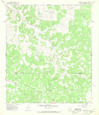
(8)- 1962 Map of Hill Ranch, 1965 Print
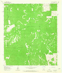 1962 Hill Ranch1965 Print · USGSTexas ranching culture is well-documented in this early 1960s survey of the Kimble and Edwards County lines. Genealogists can locate specific family lands like Cardwell Ranch, Nethery Ranch, and Jetton Ranch along the waters of Knust Draw.2 unique versions available
 - 1962 Map of Stewart Ranch, 1966 Print
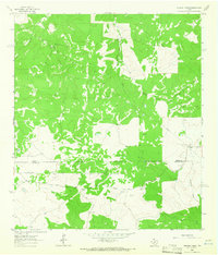 1962 Stewart Ranch1966 Print · USGSThe West Texas ranchlands along the Sutton and Edwards county line are documented here in the early 1960s. Genealogists and historians can trace family landholdings like Stewart Ranch and Miers Ranch or locate the path of Bond Road.2 unique versions available
 - 1962 Map of Bundy Ranch, 1966 Print
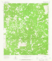 1962 Bundy Ranch1966 Print · USGSRanching outposts and river valleys define this West Texas landscape in the early sixties. Researchers can trace family-named lands like Sawyer Ranch and Mayfield Ranch or locate the remote Landing Strip and Eagle Well.2 unique versions available
 - 1963 Map of Harrison Ranch, 1965 Print
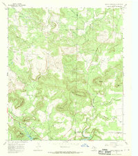
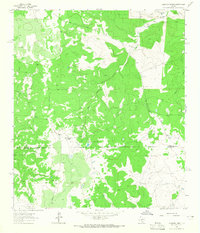 1963 Harrison Ranch1965 Print · USGSRanching and early energy development meet in the 1960s along the Sutton and Edwards county line. Local historians can trace the operations of Harrison Ranch and Brockman Ranch or locate the Miers Wilson Gas Field and its early wells.2 unique versions available
 - 1964 Map of Del Rio
 1964 Del Rio1964 Print · USGSAlong the Mexican border during the mid-sixties, this area centered on the confluence of the Rio Grande and Devils River. Researchers can trace the Southern Pacific line through isolated stops like Pumpville or locate military and industrial sites such as Laughlin Air Force Base and the mines at Blewett.
 - 1967 Map of Dunbar Draw SW, 1969 Print
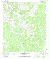
 1967 Dunbar Draw SW1969 Print · USGSSutton and Edwards Counties are shown here in the late sixties as a landscape of working ranches and oil production. Genealogists and researchers can locate family properties like Rex Cusenbary Ranch and the Texas A and M Experimental Station.3 unique versions available
 - 1967 Map of Indian Mountain, 1970 Print
 1967 Indian Mountain1970 Print · USGSThe tri-county border area of Young, Jack, and Palo Pinto counties is captured here in the late sixties as the energy industry transformed the hills. Researchers can trace family history at Center Ridge Cem or explore the old shorelines of Possum Kingdom Lake near Kisinger Mountain.
 - 1967 Map of Dunbar Draw SE, 1987 Print
 1967 Dunbar Draw SE1987 Print · USGSThe ranchlands of the Edwards Plateau are documented here during the late 1960s, showing the intersection of agriculture and industry. Researchers can trace family holdings like Epps Ranch and the research facilities at the Texas A and M Experimental Station.
End of results
Showing maps 1-8 of 8
Top cities of Edwards County
Frequently asked questions
- What are the different types of historical maps available for Edwards County?
- What is the oldest map of Edwards County?
- Where can I purchase historical maps of Edwards County for my home or office?
- Where can I download high-res historical maps of Edwards County?
- Are there historical topographic maps available for Edwards County?
- Is there historical aerial imagery available for Edwards County?
- Where are historical maps of Edwards County sourced from?