
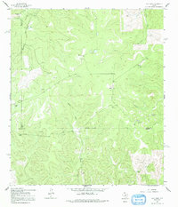
1962 Map of Hill Ranch
USGS Topo · Published 1965About this map
The Edwards Plateau ranching economy of the early 1960s is preserved in this survey of the western reaches of Kimble County. Named family holdings like Hill Ranch, Felthouse Ranch, and Gerhart Ranch dominate the landscape, connected by a network of unimproved dirt roads and light-duty trails that follow the drainage patterns of Maynard Creek and Salina Creek. The map documents a sparsely populated but active agricultural region where the tri-county junction of Sutton, Kimble, and Edwards Counties meets at an Indefinite Boundary. Numerous Gravel Pits are scattered throughout the draws, suggesting local material extraction for the maintenance of these remote ranch access routes. From the Shay Ranch in the south to the Rose Ranch in the northeast, the distribution of these homesteads illustrates the vast land requirements for livestock operations in the semi-arid Texas Hill Country.
Find a feature on this map
19 named features on this map. Tap any name to fly to it.
Don’t see what you’re looking for? This feature index may not catch every label — zoom into the map to look around manually.
Map Details
Editions of this 1962 Hill Ranch Map
2 editions found
Other maps of this area

1893 · Rock Springs
USGS Topo · 1:125,000

1926 · Segovia 2-c
USGS Topo · 1:48,000

1932 · Junction
USGS Topo · 1:62,500

1954 · Llano
USGS Topo · 1:250,000

1954 · Sonora
USGS Topo · 1:250,000

1955 · Llano
USGS Topo · 1:250,000

1956 · Llano
USGS Topo · 1:250,000

1958 · Sonora
USGS Topo · 1:250,000

1962 · Roosevelt
USGS Topo · 1:24,000
1962 · Bundy Ranch
USGS Topo · 1:24,000