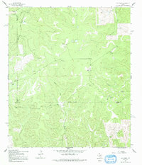
1962 Map of Hill Ranch
USGS Topo · Published 1991About this map
Hill Ranch and numerous other family-run livestock operations define the landscape of this portion of the Texas Hill Country in the early 1960s. The terrain is deeply carved by drainage systems like Maynard Draw and Knust Draw, which feed into the intermittent headwaters of Bois d'Arc Creek and Salina Creek. This area sits at a tripartite junction of administrative boundaries, where the Sutton, Kimble, and Edwards county lines meet amidst the limestone breaks.
Find a feature on this map
20 named features on this map. Tap any name to fly to it.
Don’t see what you’re looking for? This feature index may not catch every label — zoom into the map to look around manually.
Map Details
Editions of this 1962 Hill Ranch Map
2 editions found
Other maps of this area

1893 · Rock Springs
USGS Topo · 1:125,000

1926 · Segovia 2-c
USGS Topo · 1:48,000

1932 · Junction
USGS Topo · 1:62,500

1954 · Llano
USGS Topo · 1:250,000

1954 · Sonora
USGS Topo · 1:250,000

1955 · Llano
USGS Topo · 1:250,000

1956 · Llano
USGS Topo · 1:250,000

1958 · Sonora
USGS Topo · 1:250,000

1962 · Hill Ranch
USGS Topo · 1:24,000

1962 · Roosevelt
USGS Topo · 1:24,000