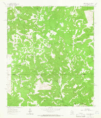
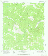
1962 Map of Bundy Ranch
USGS Topo · Published 1966About this map
The South Llano River and Llano River carve through this landscape at the intersection of the Sutton Co Edwards Co line. In the early 1960s, the area was defined by a series of isolated ranching outposts, including Sawyer Ranch, Bundy Ranch, Mayfield Ranch, and Phillips Ranch. The terrain is deeply incised by drainages such as Dragoo Hollow and West Dragoo Hollow, which dictate the placement of local roads and the numerous Gravel Pit operations scattered across the hillsides.
Find a feature on this map
18 named features on this map. Tap any name to fly to it.
Don’t see what you’re looking for? This feature index may not catch every label — zoom into the map to look around manually.
Map Details
Editions of this 1962 Bundy Ranch Map
2 editions found
Other maps of this area

1893 · Rock Springs
USGS Topo · 1:125,000

1954 · Sonora
USGS Topo · 1:250,000

1958 · Sonora
USGS Topo · 1:250,000

1962 · Hill Ranch
USGS Topo · 1:24,000

1962 · Roosevelt
USGS Topo · 1:24,000

1962 · Stewart Ranch
USGS Topo · 1:24,000

1963 · Live Oak Draw
USGS Topo · 1:24,000
1963 · Fort Terrett Ranch
USGS Topo · 1:24,000
1971 · Paint Rock Spring
USGS Topo · 1:24,000
1971 · Ray Lake
USGS Topo · 1:24,000