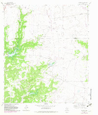
1964 Map of Sonora NE
USGS Topo · Published 1983About this map
The West Texas ranchlands of Schleicher and Sutton counties appear here as a landscape defined by industrial development and dry-wash drainage systems. The terrain is marked by the presence of numerous family-named properties, including Mertz Ranch, Caralita Ranch, and Steen Ranch, illustrating the vast pastoral landholdings of the mid-20th century. This area is heavily influenced by the petroleum industry, with extensive development visible across the Gas Field and localized Oil Field operations, supported by a network of unimproved roads and specialized infrastructure like Gas Wells and drill holes.
Find a feature on this map
22 named features on this map. Tap any name to fly to it.
Don’t see what you’re looking for? This feature index may not catch every label — zoom into the map to look around manually.
Map Details
Editions of this 1964 Sonora NE Map
2 editions found
Other maps of this area

1893 · Fort McKavett
USGS Topo · 1:125,000

1954 · Sonora
USGS Topo · 1:250,000

1958 · Sonora
USGS Topo · 1:250,000

1963 · Buffalo Well NW
USGS Topo · 1:24,000

1963 · Buffalo Well SW
USGS Topo · 1:24,000

1963 · Adams SW
USGS Topo · 1:24,000

1964 · Sonora
USGS Topo · 1:24,000

1964 · Sonora SE
USGS Topo · 1:24,000

1964 · Sonora NE
USGS Topo · 1:24,000

1964 · Eldorado SW
USGS Topo · 1:24,000