
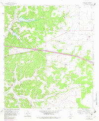
1964 Map of Sonora SE
USGS Topo · Published 1966About this map
Miers Ranch and several other family-held holdings define this mid-1960s landscape in Sutton County. The terrain is marked by a complex system of draws and plateaus, where the Atchison Topeka and Santa Fe railroad cuts through the western portion of the quadrangle near Lowrey. Water management is evident through the notation of Site No 11 and Site No 12, indicating areas subject to controlled inundation.
Find a feature on this map
20 named features on this map. Tap any name to fly to it.
Don’t see what you’re looking for? This feature index may not catch every label — zoom into the map to look around manually.
Map Details
Editions of this 1964 Sonora SE Map
2 editions found
Other maps of this area

1893 · Rock Springs
USGS Topo · 1:125,000

1893 · Fort McKavett
USGS Topo · 1:125,000

1954 · Sonora
USGS Topo · 1:250,000

1958 · Sonora
USGS Topo · 1:250,000

1963 · Steen Lake
USGS Topo · 1:24,000

1963 · Buffalo Well NW
USGS Topo · 1:24,000

1963 · Buffalo Well SW
USGS Topo · 1:24,000

1964 · Sonora
USGS Topo · 1:24,000

1964 · Sonora NE
USGS Topo · 1:24,000

1964 · Sonora NW
USGS Topo · 1:24,000