
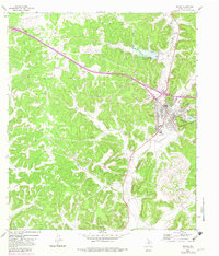
1964 Map of Sonora
USGS Topo · Published 1966About this map
Sonora serves as the focal point of this West Texas survey, situated at the confluence of the Dry Devils River and several significant arroyos. The 1964 landscape reflects a community integrated with the Atchison Topeka and Santa Fe railroad, which skirts the eastern edge of the town center. Local infrastructure of the era is remarkably detailed, featuring the Municipal Airport, a Drive-in Theater, and the Radio Tower (KCKG) near the town's southern perimeter. Beyond the developed streets, the terrain is marked by hydrological features such as Lowrey Draw and Shurley Draw, alongside emerging industrial markers like various pipelines and flood control structures designated as Site No 8 and Site No 13. The presence of several gravel pits and a Golf Course northwest of the airport indicates the varied land use between extraction and local recreation.
Find a feature on this map
20 named features on this map. Tap any name to fly to it.
Don’t see what you’re looking for? This feature index may not catch every label — zoom into the map to look around manually.
Map Details
Editions of this 1964 Sonora Map
2 editions found
Other maps of this area

1954 · Sonora
USGS Topo · 1:250,000

1958 · Sonora
USGS Topo · 1:250,000

1964 · Sonora SE
USGS Topo · 1:24,000

1964 · Sonora NE
USGS Topo · 1:24,000

1964 · Sonora NW
USGS Topo · 1:24,000

1967 · Savell Ranch
USGS Topo · 1:24,000

1967 · Dunbar Draw NW
USGS Topo · 1:24,000

1967 · Dunbar Draw NE
USGS Topo · 1:24,000

1967 · Hudspeth Draw
USGS Topo · 1:24,000

1967 · Caverns Of Sonora
USGS Topo · 1:24,000