
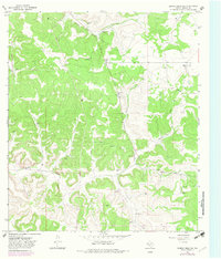
1967 Map of Dunbar Draw NE
USGS Topo · Published 1970About this map
Vanderstucken Ranch and Hunt Ranch define the settlement pattern of this Edwards Plateau landscape, where ranching and energy extraction intersect. The terrain is deeply incised by the drainage of Dunbar Draw, which dictates the movement and development of the area. Beneath the surface, the presence of Felton Cave suggests the karst topography typical of this part of Texas.
Find a feature on this map
13 named features on this map. Tap any name to fly to it.
Don’t see what you’re looking for? This feature index may not catch every label — zoom into the map to look around manually.
Map Details
Editions of this 1967 Dunbar Draw NE Map
2 editions found
Other maps of this area

1893 · Rock Springs
USGS Topo · 1:125,000

1893 · Fort McKavett
USGS Topo · 1:125,000

1954 · Sonora
USGS Topo · 1:250,000

1958 · Sonora
USGS Topo · 1:250,000

1963 · Steen Lake
USGS Topo · 1:24,000

1963 · Harrison Ranch
USGS Topo · 1:24,000

1963 · Buffalo Well SW
USGS Topo · 1:24,000

1964 · Sonora
USGS Topo · 1:24,000

1964 · Sonora SE
USGS Topo · 1:24,000

1967 · Dunbar Draw SW
USGS Topo · 1:24,000