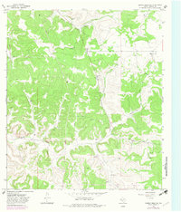
1967 Map of Dunbar Draw NE
USGS Topo · Published 1982About this map
Family ranching operations define the remote landscape of Sutton County in the late 1960s, a region where life centers around the seasonal flow of Dunbar Draw. The map meticulously records the presence of established holdings such as the Vanderstucken Ranch, Hunt Ranch, and Wyatt Ranch, reflecting the enduring pastoral economy of this Texas plateau. Beyond agriculture, the terrain is marked by industrial activity, including numerous gravel extraction sites and energy infrastructure indicated by a Gas Well and Drill Hole. The presence of Felton Cave and various wells scattered across the grid highlights the importance of subterranean resources in this arid environment. Travel through this territory is facilitated by unimproved dirt tracks and Bond Road, which link the isolated homesteads and ranching tracts across the draw.
Find a feature on this map
15 named features on this map. Tap any name to fly to it.
Don’t see what you’re looking for? This feature index may not catch every label — zoom into the map to look around manually.
Map Details
Editions of this 1967 Dunbar Draw NE Map
2 editions found

Other maps of this area

1893 · Rock Springs
USGS Topo · 1:125,000

1893 · Fort McKavett
USGS Topo · 1:125,000

1954 · Sonora
USGS Topo · 1:250,000

1958 · Sonora
USGS Topo · 1:250,000

1963 · Steen Lake
USGS Topo · 1:24,000

1963 · Harrison Ranch
USGS Topo · 1:24,000

1963 · Buffalo Well SW
USGS Topo · 1:24,000

1964 · Sonora
USGS Topo · 1:24,000

1964 · Sonora SE
USGS Topo · 1:24,000

1967 · Dunbar Draw SW
USGS Topo · 1:24,000