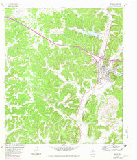
1964 Map of Sonora
USGS Topo · Published 1983About this map
Sonora sits at the junction of several critical regional transit routes in this mid-century survey, updated through the early 1980s. The town's infrastructure reflects its role as a county seat and hub for the surrounding ranching and energy landscape, featuring the Municipal Airport, a Drive-in Theater, and an Athletic Field. To the south and east, the drainage of the Dry Devils River and Shurley Draw carves through the terrain, while the broader landscape of Sutton is marked by numerous Gas Well and Gravel Pit operations, indicating a heavy reliance on mineral extraction.
Find a feature on this map
20 named features on this map. Tap any name to fly to it.
Don’t see what you’re looking for? This feature index may not catch every label — zoom into the map to look around manually.
Map Details
Editions of this 1964 Sonora Map
2 editions found
Other maps of this area

1954 · Sonora
USGS Topo · 1:250,000

1958 · Sonora
USGS Topo · 1:250,000

1964 · Sonora
USGS Topo · 1:24,000

1964 · Sonora SE
USGS Topo · 1:24,000

1964 · Sonora NE
USGS Topo · 1:24,000

1964 · Sonora NW
USGS Topo · 1:24,000

1967 · Savell Ranch
USGS Topo · 1:24,000

1967 · Dunbar Draw NW
USGS Topo · 1:24,000

1967 · Dunbar Draw NE
USGS Topo · 1:24,000

1967 · Hudspeth Draw
USGS Topo · 1:24,000