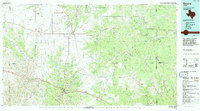
1994 Map of Sonora
USGS Topo · Published 1994About this map
The Edwards Plateau landscape of West Texas is defined here by the headwaters of several major river systems and a prolific energy industry. The map captures the intersection of the South Concho River, the San Saba River, and the Llano River, which carve deep drainage networks across the terrain such as Prong Valley and Antelope Draw. This 1994 edition reveals a region heavily utilized for its natural resources, with extensive infrastructure for the Page Oil and Gas Field, Eldorado Canyon Gas Field, and Huldahl Oil Field. Local landmarks like the Caverns of Sonora south of the city and Bramley Mountain provide distinct geographic orientation. The presence of a legacy Railroad Grade near Eldorado points to the area's transport history, while the sprawling network of draws and hollows underscores the arid landscape's seasonal water patterns.
Find a feature on this map
62 named features on this map. Tap any name to fly to it.
Don’t see what you’re looking for? This feature index may not catch every label — zoom into the map to look around manually.
Map Details
Editions of this 1994 Sonora Map
This is the sole edition of this map. No revisions or reprints were ever made.
Other maps of this area

1892 · San Angelo
USGS Topo · 1:125,000

1892 · Eden
USGS Topo · 1:125,000

1893 · Rock Springs
USGS Topo · 1:125,000

1893 · Fort McKavett
USGS Topo · 1:125,000

1895 · Sherwood
USGS Topo · 1:125,000

1896 · Eden
USGS Topo · 1:125,000

1920 · Barnhart
USGS Topo · 1:62,500

1922 · Barnhart
USGS Topo · 1:62,500

1932 · Junction
USGS Topo · 1:62,500

1954 · Brownwood
USGS Topo · 1:250,000