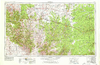
1954 Map of Sonora
USGS Topo · Published 1979About this map
The Divide Country of the Edwards Plateau dominates this mid-century survey, illustrating a landscape defined by deep draws and canyons that channel water toward the Pecos River and the various forks of the Llano and Devils rivers. The transition from the rugged canyonlands in the west to the higher ranching country of Sutton County is evident, with Sonora and Ozona serving as the primary commercial hubs along the developing U.S. 290 corridor.
Find a feature on this map
39 named features on this map. Tap any name to fly to it.
Don’t see what you’re looking for? This feature index may not catch every label — zoom into the map to look around manually.
Map Details
Editions of this 1954 Sonora Map
2 editions found

Other maps of this area

1892 · San Angelo
USGS Topo · 1:125,000

1892 · Eden
USGS Topo · 1:125,000

1893 · Rock Springs
USGS Topo · 1:125,000

1893 · Fort McKavett
USGS Topo · 1:125,000

1893 · Nueces
USGS Topo · 1:125,000

1895 · Sherwood
USGS Topo · 1:125,000

1896 · Nueces
USGS Topo · 1:125,000

1896 · Eden
USGS Topo · 1:125,000

1918 · Dryden Crossing
USGS Topo · 1:62,500

1920 · Big Lake
USGS Topo · 1:62,500