
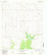
1964 Map of Eldorado SW
USGS Topo · Published 1966About this map
Dry Devils River snakes through this portion of Schleicher County, illustrating the arid landscape of the Edwards Plateau during the mid-1960s. The map highlights a rural economy dependent on ranching and infrastructure, marked by the Johnson Ranch and Willoughby Ranch. Water management is a primary focus, visible through the presence of Site No 1, an area designated for controlled inundation near a spillway. Genealogists and local historians will find value in the documentation of the Eldorado Cem and the more remote Bailey Ranch Cem. The industrial footprint of the era is represented by numerous Gravel Pits, a network of Pipelines, and a Pumping Station, showing the integration of resource extraction and transport into the traditional ranching landscape.
Find a feature on this map
12 named features on this map. Tap any name to fly to it.
Don’t see what you’re looking for? This feature index may not catch every label — zoom into the map to look around manually.
Map Details
Editions of this 1964 Eldorado SW Map
2 editions found
Other maps of this area

1954 · Sonora
USGS Topo · 1:250,000

1958 · Sonora
USGS Topo · 1:250,000

1964 · Eldorado NW
USGS Topo · 1:24,000

1964 · Sonora NE
USGS Topo · 1:24,000

1964 · Sonora NW
USGS Topo · 1:24,000

1964 · Coupe Ranch
USGS Topo · 1:24,000
1964 · Eldorado NE
USGS Topo · 1:24,000
1964 · Eldorado
USGS Topo · 1:24,000

1964 · Moore Ranch
USGS Topo · 1:24,000

1967 · Savell Ranch
USGS Topo · 1:24,000