
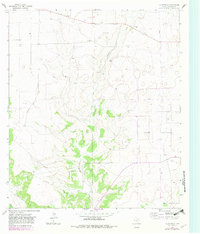
1964 Map of Coupe Ranch
USGS Topo · Published 1966About this map
Coupe Ranch serves as a central landmark in this mid-1960s study of the West Texas landscape, where large-scale cattle ranching and modern infrastructure intersect. The terrain is defined by the winding course of Granger Draw, which cuts through the plateau alongside notable family-held properties such as Speck Ranch and Mayer Ranch. This era shows the increasing industrialization of the backcountry, marked by a prominent Pipeline corridor and the inclusion of a Landing Strip and Gas Well, indicating the transition of the local economy toward energy and rapid transportation. Further south, Buckhorn Draw and Meador Ranch anchor the southern reaches of the quadrangle. Scattered Gravel Pits across the map highlight the localized extraction efforts supporting the expansion of regional roads during this period of rural development in Schleicher County.
Find a feature on this map
12 named features on this map. Tap any name to fly to it.
Don’t see what you’re looking for? This feature index may not catch every label — zoom into the map to look around manually.
Map Details
Editions of this 1964 Coupe Ranch Map
2 editions found
Other maps of this area

1954 · Sonora
USGS Topo · 1:250,000

1958 · Sonora
USGS Topo · 1:250,000

1964 · Eldorado NW
USGS Topo · 1:24,000

1964 · Eldorado SW
USGS Topo · 1:24,000

1964 · Oglesby Ranch
USGS Topo · 1:24,000

1964 · Sonora NW
USGS Topo · 1:24,000

1964 · Bailey Draw
USGS Topo · 1:24,000

1964 · Moore Ranch
USGS Topo · 1:24,000

1967 · Nolen Draw
USGS Topo · 1:24,000

1967 · Savell Ranch
USGS Topo · 1:24,000