
1964 Map of Eldorado NW
USGS Topo · Published 1966About this map
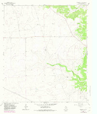
Schleicher County ranchlands define this West Texas landscape, where large family holdings like Bearce Ranch and Meador Ranch occupy the high, dry plains. The map illustrates the region's mid-century transition into an energy-producing hub, centered on the Eldorado Gas Field and a network of pipelines that cut across the terrain. While the upland reaches are marked by scattered gas wells, the topography is carved by natural drainage systems such as Whitten Draw and Indian Draw, leading toward a deep Canyon in the southeast. This 1964 survey provides a specific record of land use, showing the exact placement of homesteads like Whitten Ranch and Page Ranch alongside industrial features like Gravel Pits and various drilling sites, documenting the coexistence of traditional cattle ranching and the burgeoning petroleum industry.
Find a feature on this map
15 named features on this map. Tap any name to fly to it.
Don’t see what you’re looking for? This feature index may not catch every label — zoom into the map to look around manually.
Map Details
Editions of this 1964 Eldorado NW Map
2 editions found
Other maps of this area

1895 · Sherwood
USGS Topo · 1:125,000

1954 · Sonora
USGS Topo · 1:250,000

1954 · San Angelo
USGS Topo · 1:250,000

1958 · Sonora
USGS Topo · 1:250,000

1958 · San Angelo
USGS Topo · 1:250,000

1964 · Eldorado SW
USGS Topo · 1:24,000

1964 · Coupe Ranch
USGS Topo · 1:24,000
1964 · Eldorado NE
USGS Topo · 1:24,000
1964 · Eldorado
USGS Topo · 1:24,000

1964 · Moore Ranch
USGS Topo · 1:24,000