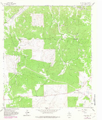
1963 Map of Buffalo Well
USGS Topo · Published 1983About this map
The county boundary between Schleicher Co and Sutton Co cuts across this high plateau landscape, where the local economy in the early 1960s was defined by ranching and the burgeoning energy sector. Remote outposts such as Buffalo Well and the Wardlaw Ranch anchor the territory, while the presence of the Humble Camp and a Pumping Sta north of Bull Hollow highlights the industrial footprint of petroleum extraction.
Find a feature on this map
18 named features on this map. Tap any name to fly to it.
Don’t see what you’re looking for? This feature index may not catch every label — zoom into the map to look around manually.
Map Details
Editions of this 1963 Buffalo Well Map
2 editions found
Other maps of this area

1893 · Fort McKavett
USGS Topo · 1:125,000

1954 · Sonora
USGS Topo · 1:250,000

1958 · Sonora
USGS Topo · 1:250,000

1963 · Buffalo Well
USGS Topo · 1:24,000

1963 · Buffalo Well NW
USGS Topo · 1:24,000

1963 · Buffalo Well SE
USGS Topo · 1:24,000

1963 · Adams SE
USGS Topo · 1:24,000
1963 · Brokeleg Mountain
USGS Topo · 1:24,000

1963 · Buffalo Well SW
USGS Topo · 1:24,000

1963 · Adams SW
USGS Topo · 1:24,000