
1963 Map of Buffalo Well SE
USGS Topo · Published 1966About this map
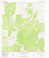
The North Llano River carves through this portion of the Texas hill country, joined by the long reaches of Buffalo Draw and Tenmile Draw. In the early 1960s, the landscape was defined by an extensive network of family-held ranching estates, including the Shroyer Ranch, Alley Ranch, and several properties belonging to the Hardgrave and Baker families. These ranch boundaries, often demarcated by the fine red dashed lines of selected fence lines, illustrate the parceling of the Edwards Plateau for livestock.
Find a feature on this map
17 named features on this map. Tap any name to fly to it.
Don’t see what you’re looking for? This feature index may not catch every label — zoom into the map to look around manually.
Map Details
Editions of this 1963 Buffalo Well SE Map
2 editions found
Other maps of this area

1893 · Rock Springs
USGS Topo · 1:125,000

1893 · Fort McKavett
USGS Topo · 1:125,000

1954 · Sonora
USGS Topo · 1:250,000

1958 · Sonora
USGS Topo · 1:250,000

1963 · Steen Lake
USGS Topo · 1:24,000

1963 · Buffalo Well
USGS Topo · 1:24,000

1963 · Live Oak Draw
USGS Topo · 1:24,000

1963 · Buffalo Well NW
USGS Topo · 1:24,000
1963 · Fort Terrett Ranch
USGS Topo · 1:24,000
1963 · Brokeleg Mountain
USGS Topo · 1:24,000