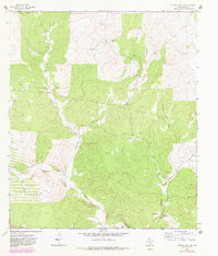
1963 Map of Buffalo Well SE
USGS Topo · Published 1982About this map
North Llano River valley life in the early 1960s is defined by a sparse network of family-held ranch lands and deep drainage patterns. This West Texas landscape, characterized by the rugged Ibrokeleg Mountain and the converging paths of Buffalo Draw and Tenmile Draw, illustrates the isolated nature of cattle country before modern expansion. Scattered settlements like Abney Ranch, Shroyer Ranch, and Allison Ranch are connected by a mix of unimproved tracks and the locally significant Baker Road. The presence of the Little Ogden Waterhole provides a specific point of interest for those studying the water management and livestock history of the region. This 1963 survey, updated in the early 1980s, documents a transition in infrastructure, noting several Gravel Pits and a Landing Strip that hint at the industrial and logistical shifts occurring in Sutton County.
Find a feature on this map
20 named features on this map. Tap any name to fly to it.
Don’t see what you’re looking for? This feature index may not catch every label — zoom into the map to look around manually.
Map Details
Editions of this 1963 Buffalo Well SE Map
2 editions found
Other maps of this area

1893 · Rock Springs
USGS Topo · 1:125,000

1893 · Fort McKavett
USGS Topo · 1:125,000

1954 · Sonora
USGS Topo · 1:250,000

1958 · Sonora
USGS Topo · 1:250,000

1963 · Steen Lake
USGS Topo · 1:24,000

1963 · Buffalo Well
USGS Topo · 1:24,000

1963 · Live Oak Draw
USGS Topo · 1:24,000

1963 · Buffalo Well NW
USGS Topo · 1:24,000

1963 · Buffalo Well SE
USGS Topo · 1:24,000
1963 · Fort Terrett Ranch
USGS Topo · 1:24,000