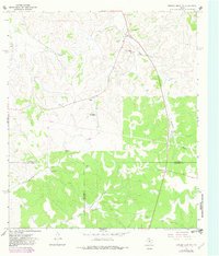
1967 Map of Dunbar Draw SW
USGS Topo · Published 1982About this map
The Mack Cauthorn Ranch and Dan Cauthorn Ranch anchor this West Texas ranching landscape at the intersection of Sutton, Val Verde, and Edwards Counties. Surveyed in 1967 with revisions from 1979, the map reveals a rugged terrain defined by seasonal watercourses like Cauthorn Draw and Buckley Draw. These intermittent drainages, along with man-made water sources such as Buckley Tank and Chester Well, were essential for cattle operations in an area where permanent surface water is scarce.
Find a feature on this map
16 named features on this map. Tap any name to fly to it.
Don’t see what you’re looking for? This feature index may not catch every label — zoom into the map to look around manually.
Map Details
Editions of this 1967 Dunbar Draw SW Map
Other maps of this area

1954 · Sonora
USGS Topo · 1:250,000

1958 · Sonora
USGS Topo · 1:250,000

1967 · Dunbar Draw SW
USGS Topo · 1:24,000

1967 · Flat Rock Draw SE
USGS Topo · 1:24,000

1967 · Dunbar Draw NW
USGS Topo · 1:24,000

1967 · Dunbar Draw NE
USGS Topo · 1:24,000

1967 · Hudspeth Draw
USGS Topo · 1:24,000

1967 · Dunbar Draw SE
USGS Topo · 1:24,000
1971 · Turney Draw NE
USGS Topo · 1:24,000

1973 · Turney Draw NW
USGS Topo · 1:24,000