
1973 Map of Turney Draw NW
USGS Topo · Published 1975About this map
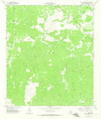
The Val Verde and Edwards County line bisects this 1970s landscape, where cattle ranching and water access dictate the patterns of settlement. High desert terrain is carved by ephemeral drainage systems like South Draw and Turney Draw, which feed into the more prominent Devils River. The area's agricultural life centers on established properties such as the Whitehead Ranch and Barnhart Ranch, supported by a critical network of remote water infrastructure. Scattered windmills including the Buckley Windmill, Heifer Windmill, and Mutton Pasture Windmill are meticulously mapped, serving as vital landmarks for local history and land management. This survey captures a specific era of West Texas ranching before modern consolidation, documenting the exact placement of gravel pits and exploratory drill holes across the arid draws.
Find a feature on this map
16 named features on this map. Tap any name to fly to it.
Don’t see what you’re looking for? This feature index may not catch every label — zoom into the map to look around manually.
Map Details
Editions of this 1973 Turney Draw NW Map
This is the sole edition of this map. No revisions or reprints were ever made.
Other maps of this area

1954 · Sonora
USGS Topo · 1:250,000

1958 · Sonora
USGS Topo · 1:250,000

1967 · Dunbar Draw SW
USGS Topo · 1:24,000

1967 · Flat Rock Draw SE
USGS Topo · 1:24,000

1967 · Dunbar Draw SE
USGS Topo · 1:24,000

1971 · Turney Draw SE
USGS Topo · 1:24,000
1971 · Turney Draw NE
USGS Topo · 1:24,000

1973 · Robinson Draw
USGS Topo · 1:24,000

1973 · Four Mills
USGS Topo · 1:24,000
1973 · White Draw NE
USGS Topo · 1:24,000