
1973 Map of Robinson Draw
USGS Topo · Published 1976About this map
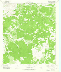
Dolan Creek and Robinson Draw carve through this section of Val Verde County, defining a landscape shaped by water and the search for it. In the early 1970s, this area of West Texas remained characterized by large pastoral holdings, with operations like the Whitehead Brothers Ranch, Taylor Ranch, and Rose Ranch utilizing the drainage systems and a network of named water-pumping stations. The map reveals the critical infrastructure of ranching life, documented by the numerous numbered and named pumps such as Alta Windmill, Double Dolan Windmill, and Pastry Windmill. A single Landing Strip and a few scattered Gravel Pit sites represent the sparse industrial and transportation footprints in this territory, where fence lines and topography dictate the movement across the land.
Find a feature on this map
18 named features on this map. Tap any name to fly to it.
Don’t see what you’re looking for? This feature index may not catch every label — zoom into the map to look around manually.
Map Details
Editions of this 1973 Robinson Draw Map
This is the sole edition of this map. No revisions or reprints were ever made.
Other maps of this area

1943 · Carta Valley
USGS Topo · 1:62,500

1944 · Dry Devil
USGS Topo · 1:62,500

1954 · Sonora
USGS Topo · 1:250,000

1958 · Sonora
USGS Topo · 1:250,000

1958 · Del Rio
USGS Topo · 1:250,000

1964 · Del Rio
USGS Topo · 1:250,000

1973 · Turney Draw NW
USGS Topo · 1:24,000

1973 · White Draw NW
USGS Topo · 1:24,000

1973 · Four Mills
USGS Topo · 1:24,000
1973 · White Draw NE
USGS Topo · 1:24,000