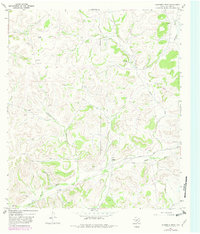
1967 Map of Hudspeth Draw
USGS Topo · Published 1982About this map
The Dry Devils River carves through the landscape of Sutton County, defining a region characterized by deep drainage draws and scattered ranching outposts. This 1967 survey, updated with 1982 revisions, reveals a territory where water management is central to the land's utility, evidenced by a network of family-named water sources including Potter Well, Binyon Well, and Stokes Well. The Old Juno Road serves as a primary transit artery across the southern portion of the sheet, connecting the remote hills to regional hubs. Large landholdings like the F A Hill Ranch, W Sawyer Ranch, and Aldwell Ranch dominate the topography, illustrating the persistence of large-scale pastoral operations in the Edwards Plateau region. The map also traces industrial infrastructure through a prominent Pipeline and multiple Gravel Pits, while natural features like Hudspeth Draw and Sawyer Draw underscore the rugged hydrology of the Texas backcountry.
Find a feature on this map
18 named features on this map. Tap any name to fly to it.
Don’t see what you’re looking for? This feature index may not catch every label — zoom into the map to look around manually.
Map Details
Editions of this 1967 Hudspeth Draw Map
2 editions found
Other maps of this area

1954 · Sonora
USGS Topo · 1:250,000

1958 · Sonora
USGS Topo · 1:250,000

1964 · Sonora
USGS Topo · 1:24,000

1967 · Dunbar Draw SW
USGS Topo · 1:24,000

1967 · Flat Rock Draw SE
USGS Topo · 1:24,000

1967 · Dunbar Draw NW
USGS Topo · 1:24,000

1967 · Flat Rock Draw SW
USGS Topo · 1:24,000

1967 · Shafter Draw
USGS Topo · 1:24,000

1967 · Hudspeth Draw
USGS Topo · 1:24,000

1967 · Caverns Of Sonora
USGS Topo · 1:24,000