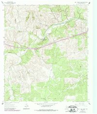
1963 Map of Fort Terrett Ranch
USGS Topo · Published 1987About this map
The Fort Terrett Ranch (Historical Site) sits near the bend of the North Llano River, marking a location of significant frontier importance in Sutton County. This 1963 survey (with 1980s updates) illustrates a landscape defined by deep draws and limestone bluffs, where reliable water sources like the Kingfisher Waterhole and the Dry Llano River dictated the placement of early ranching outposts. The map reveals the distribution of family-held lands, including the Anderson Ranch, Foster Ranch, and Bundy Ranch, each situated to manage the challenging terrain of the Edwards Plateau.
Find a feature on this map
28 named features on this map. Tap any name to fly to it.
Don’t see what you’re looking for? This feature index may not catch every label — zoom into the map to look around manually.
Map Details
Editions of this 1963 Fort Terrett Ranch Map
2 editions found
Other maps of this area

1893 · Rock Springs
USGS Topo · 1:125,000

1893 · Fort McKavett
USGS Topo · 1:125,000

1954 · Sonora
USGS Topo · 1:250,000

1958 · Sonora
USGS Topo · 1:250,000

1962 · Hill Ranch
USGS Topo · 1:24,000

1962 · Roosevelt
USGS Topo · 1:24,000

1962 · Stewart Ranch
USGS Topo · 1:24,000
1962 · Bundy Ranch
USGS Topo · 1:24,000

1963 · Live Oak Draw
USGS Topo · 1:24,000

1963 · McKegan Draw
USGS Topo · 1:24,000