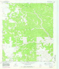
1963 Map of Steen Lake
USGS Topo · Published 1982About this map
Steen Lake and the smaller Lost Lake anchor a landscape defined by ranching and resource extraction in the Edwards Plateau region. The map reveals a high concentration of family-held land, including multiple properties owned by the Wallace and Wilson families such as the Miers Wilson Ranch and George Wallace Ranch. These settlements are connected by a network of ranch roads and pipelines that intersect the undulating terrain, suggesting a transition toward energy development in the mid-20th century.
Find a feature on this map
18 named features on this map. Tap any name to fly to it.
Don’t see what you’re looking for? This feature index may not catch every label — zoom into the map to look around manually.
Map Details
Editions of this 1963 Steen Lake Map
2 editions found
Other maps of this area

1893 · Rock Springs
USGS Topo · 1:125,000

1893 · Fort McKavett
USGS Topo · 1:125,000

1954 · Sonora
USGS Topo · 1:250,000

1958 · Sonora
USGS Topo · 1:250,000

1962 · Stewart Ranch
USGS Topo · 1:24,000

1963 · Steen Lake
USGS Topo · 1:24,000

1963 · Harrison Ranch
USGS Topo · 1:24,000

1963 · Live Oak Draw
USGS Topo · 1:24,000

1963 · Buffalo Well SE
USGS Topo · 1:24,000

1963 · Buffalo Well SW
USGS Topo · 1:24,000